Blajan geodata
Blajan (Occitanie) is a populated place; located in France in Europe/Paris (GMT+2) time zone. With population of 533 people, there are 14546 cities with bigger population in this country. Compared to other cities in France, 96.4% of cities are located further ↑North; 72% of cities are located further →East and 85.5% of cities have lower elevation than Blajan. Note1
Administrative division(s):
- Level 1: Occitanie
- Level 2: Haute-Garonne
- Level 3: Arrondissement de Saint-Gaudens
- Level 4: Blajan


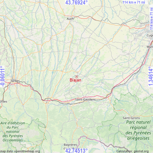
Blajan GPS coordinates[2]
43° 15' 33.624" North, 0° 38' 34.872" East
| Map corner | latitude | longitude |
|---|---|---|
| Upper-left | 43.76924°, | -0.06011° |
| Center: | 43.25934°, | 0.64302° |
| Lower-right: | 42.74513°, | 1.34614° |
| Map W x H: | 113.9×113.9 km | = 70.8×70.8mi |
| max Lat: | 51.07786° ⇑96.4% North |
| Blajan: | 43.25934° |
| min Lat: | ⇓3.6% South 41.3874° |
| min Long | Blajan | max Long |
| -5.08615° | 0.64302° | 9.52242° |
| W 28%⇐ | ⇒72% E |
Elevation
Elevation of Blajan is 352 m = 1155 ft, and this is 158.3 m = 519 ft above average elevation for this country.
| Max E: |
2333 m = 7654 ft | 14.5% |
| Blajan | 352 m 1155 ft | |
| Avg. | 193.7 m = 635 ft | |
Min E: |
-1 m = -3 ft | 85.5% |
See also: France elevation on elevation.city.
Geographical zone
Blajan is located in North temperate zone (between Tropic of Cancer and the Arctic Circle). Distance of this Northern Tropic circle is 2204.1 km =1369.6 mi to South.| Distance of | km | miles | from Blajan |
|---|---|---|---|
| North Pole | 5197.1 | 3229.3 | to North |
| Arctic Circle | 2591.2 | 1610.1 | to North |
| Tropic Cancer | 2204.1 | 1369.6 | to South |
| Equator | 4810 | 2988.8 | to South |


Nearby cities:
15 places around Blajan: (largest is in red/bold)
• Aurignac
19.9 km =12.4 mi,  103°
103°
• Ausson
20.1 km =12.5 mi,  191°
191°
• Boulogne-sur-Gesse
4.6 km =2.9 mi,  7°
7°
• Castelnau-Magnoac
11.7 km =7.3 mi,  289°
289°
• Clarac
18.1 km =11.2 mi,  184°
184°
• Galan
19.6 km =12.2 mi,  257°
257°
• Labarthe-Rivière
20 km =12.4 mi,  173°
173°
• Landorthe
18.4 km =11.4 mi,  141°
141°
• Masseube
19.7 km =12.2 mi,  344°
344°
• Monléon-Magnoac
10.2 km =6.3 mi, 264°
• Pointis-de-Rivière
19.2 km =11.9 mi, 186°
• Ponlat-Taillebourg
17 km =10.6 mi, 191°
• Saint-Gaudens
18 km =11.2 mi,  158°
158°
• Valentine
18.9 km =11.7 mi, 165°
• Villeneuve-de-Rivière
14.7 km =9.1 mi, 173°
Sources, notices
• [Note1] Compared only with cities in France existing in our database
• [Src1] Map data: © OpenStreetMap contributors (CC-BY-SA)
• [Src2] Other city data from geonames.org with taken over terms of usage.
• [Src3] Geographical zone / Annual Mean Temperature by Robert A. Rohde @ Wikipedia
