Baudreix geodata
Baudreix (Nouvelle-Aquitaine) is a seat of a fourth-order administrative division; located in France in Europe/Paris (GMT+2) time zone. With population of 625 people, there are 12901 cities with bigger population in this country. Compared to other cities in France, 97.1% of cities are located further ↑North; 80.4% of cities are located further →East and 75.1% of cities have lower elevation than Baudreix. Note1
Administrative division(s):
- Level 1: Nouvelle-Aquitaine
- Level 2: Département des Pyrénées-Atlantiques
- Level 3: Arrondissement de Pau
- Level 4: Baudreix


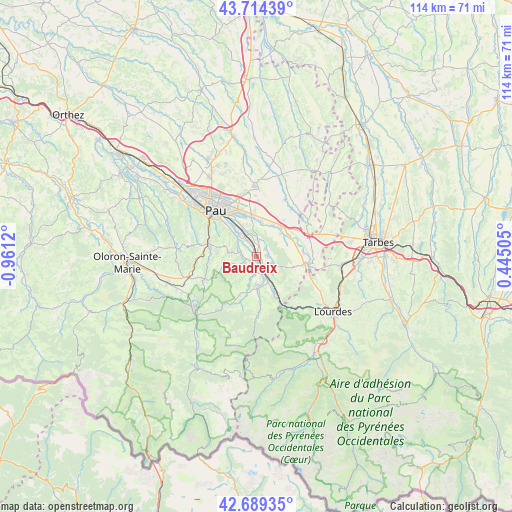
Baudreix GPS coordinates[2]
43° 12' 14.472" North, 0° 15' 29.052" West
| Map corner | latitude | longitude |
|---|---|---|
| Upper-left | 43.71439°, | -0.9612° |
| Center: | 43.20402°, | -0.25807° |
| Lower-right: | 42.68935°, | 0.44505° |
| Map W x H: | 114×114 km | = 70.8×70.8mi |
| max Lat: | 51.07786° ⇑97.1% North |
| Baudreix: | 43.20402° |
| min Lat: | ⇓2.9% South 41.3874° |
| min Long | Baudreix | max Long |
| -5.08615° | -0.25807° | 9.52242° |
| W 19.6%⇐ | ⇒80.4% E |
Elevation
Elevation of Baudreix is 250 m = 820 ft, and this is 56.3 m = 185 ft above average elevation for this country.
| Max E: |
2333 m = 7654 ft | 24.9% |
| Baudreix | 250 m 820 ft | |
| Avg. | 193.7 m = 635 ft | |
Min E: |
-1 m = -3 ft | 75.1% |
See also: France elevation on elevation.city.
Geographical zone
Baudreix is located in North temperate zone (between Tropic of Cancer and the Arctic Circle). Distance of this Northern Tropic circle is 2197.9 km =1365.7 mi to South.| Distance of | km | miles | from Baudreix |
|---|---|---|---|
| North Pole | 5203.2 | 3233.1 | to North |
| Arctic Circle | 2597.3 | 1613.9 | to North |
| Tropic Cancer | 2197.9 | 1365.7 | to South |
| Equator | 4803.8 | 2984.9 | to South |


Nearby cities:
15 places around Baudreix: (largest is in red/bold)
• Angaïs
3.3 km =2.1 mi,  11°
11°
• Arros-de-Nay
2.1 km =1.3 mi,  257°
257°
• Artigueloutan
7 km =4.3 mi, 5°
• Assat
6.1 km =3.8 mi,  326°
326°
• Asson
6 km =3.7 mi,  173°
173°
• Beuste
2.4 km =1.5 mi,  54°
54°
• Boeil-Bezing
1.6 km =1 mi, 333°
• Bordes
3.8 km =2.4 mi, 327°
• Bordères
3.4 km =2.1 mi,  97°
97°
• Bénéjacq
3.4 km =2.1 mi, 97°
• Coarraze
4.6 km =2.9 mi,  154°
154°
• Igon
4.6 km =2.9 mi, 154°
• Lagos
3.6 km =2.2 mi,  67°
67°
• Mirepeix
2.4 km =1.5 mi,  164°
164°
• Nay
2.4 km =1.5 mi,  196°
196°
Sources, notices
• [Note1] Compared only with cities in France existing in our database
• [Src1] Map data: © OpenStreetMap contributors (CC-BY-SA)
• [Src2] Other city data from geonames.org with taken over terms of usage.
• [Src3] Geographical zone / Annual Mean Temperature by Robert A. Rohde @ Wikipedia
