Bachant geodata
Bachant (Hauts-de-France) is a populated place; located in France in Europe/Paris (GMT+2) time zone. With population of 2,415 people, there are 4006 cities with bigger population in this country. Compared to other cities in France, 94.9% of cities are located further ↓South; 66.7% of cities are located further ←West and 53.1% of cities have lower elevation than Bachant. Note1
Administrative division(s):
- Level 1: Hauts-de-France
- Level 2: Nord
- Level 3: Avesnes-sur-Helpe
- Level 4: Bachant


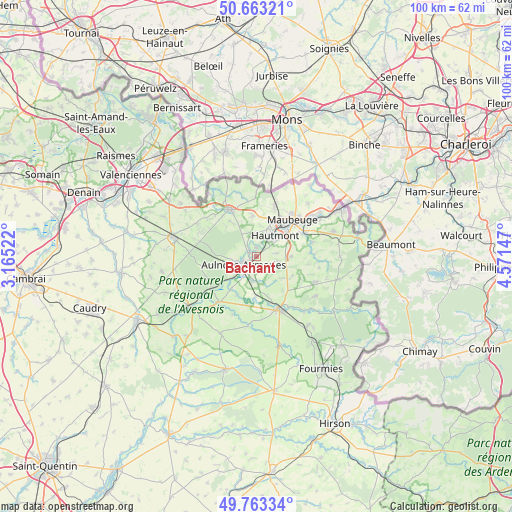
Bachant GPS coordinates[2]
50° 12' 55.44" North, 3° 52' 6.06" East
| Map corner | latitude | longitude |
|---|---|---|
| Upper-left | 50.66321°, | 3.16522° |
| Center: | 50.2154°, | 3.86835° |
| Lower-right: | 49.76334°, | 4.57147° |
| Map W x H: | 100.1×100.1 km | = 62.2×62.2mi |
| max Lat: | 51.07786° ⇑5.1% North |
| Bachant: | 50.2154° |
| min Lat: | ⇓94.9% South 41.3874° |
| min Long | Bachant | max Long |
| -5.08615° | 3.86835° | 9.52242° |
| W 66.7%⇐ | ⇒33.3% E |
Elevation
Elevation of Bachant is 143 m = 469 ft, and this is 50.7 m = 166 ft below average elevation for this country.
| Max E: |
2333 m = 7654 ft | 46.9% |
| Avg. | 193.7 m = 635 ft | |
| Bachant | 143 m = 469 ft | |
Min E: |
-1 m = -3 ft | 53.1% |
See also: France elevation on elevation.city.
Geographical zone
Bachant is located in North temperate zone (between Tropic of Cancer and the Arctic Circle). Distance of this North polar circle is 1817.7 km =1129.5 mi to North.| Distance of | km | miles | from Bachant |
|---|---|---|---|
| North Pole | 4423.6 | 2748.7 | to North |
| Arctic Circle | 1817.7 | 1129.5 | to North |
| Tropic Cancer | 2977.5 | 1850.1 | to South |
| Equator | 5583.4 | 3469.4 | to South |


Nearby cities:
15 places around Bachant: (largest is in red/bold)
• Aulnoye-Aymeries
2.6 km =1.6 mi,  233°
233°
• Berlaimont
4.2 km =2.6 mi,  248°
248°
• Dompierre-sur-Helpe
8.1 km =5 mi,  182°
182°
• Feignies
9.8 km =6.1 mi,  19°
19°
• Hautmont
5.5 km =3.4 mi,  43°
43°
• La Longueville
8.3 km =5.2 mi,  354°
354°
• Leval
4.7 km =2.9 mi,  214°
214°
• Louvroil
8.6 km =5.3 mi,  51°
51°
• Mecquignies
8.7 km =5.4 mi,  322°
322°
• Monceau-Saint-Waast
5.1 km =3.2 mi,  192°
192°
• Obies
8.3 km =5.2 mi,  314°
314°
• Pont-sur-Sambre
1.7 km =1.1 mi,  295°
295°
• Saint-Hilaire-sur-Helpe
9.6 km =6 mi,  165°
165°
• Taisnières-en-Thiérache
8.4 km =5.2 mi, 206°
• Vieux-Mesnil
4.2 km =2.6 mi, 353°
Sources, notices
• [Note1] Compared only with cities in France existing in our database
• [Src1] Map data: © OpenStreetMap contributors (CC-BY-SA)
• [Src2] Other city data from geonames.org with taken over terms of usage.
• [Src3] Geographical zone / Annual Mean Temperature by Robert A. Rohde @ Wikipedia
