Ax-les-Thermes geodata
Ax-les-Thermes (Occitanie) is a populated place; located in France in Europe/Paris (GMT+2) time zone. With population of 1,510 people, there are 6158 cities with bigger population in this country. Compared to other cities in France, 99% of cities are located further ↑North; 59% of cities are located further →East and 97% of cities have lower elevation than Ax-les-Thermes. Note1
Administrative division(s):
- Level 1: Occitanie
- Level 2: Département de l'Ariège
- Level 3: Arrondissement de Foix
- Level 4: Ax-les-Thermes


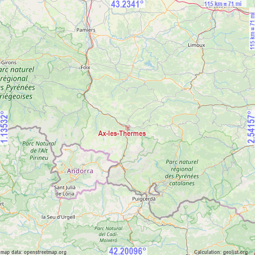
Ax-les-Thermes GPS coordinates[2]
42° 43' 10.848" North, 1° 50' 18.42" East
| Map corner | latitude | longitude |
|---|---|---|
| Upper-left | 43.2341°, | 1.13532° |
| Center: | 42.71968°, | 1.83845° |
| Lower-right: | 42.20096°, | 2.54157° |
| Map W x H: | 114.9×114.9 km | = 71.4×71.4mi |
| max Lat: | 51.07786° ⇑99% North |
| Ax-les-Thermes: | 42.71968° |
| min Lat: | ⇓1% South 41.3874° |
| min Long | Ax-les-Thermes | max Long |
| -5.08615° | 1.83845° | 9.52242° |
| W 41%⇐ | ⇒59% E |
Elevation
Elevation of Ax-les-Thermes is 722 m = 2369 ft, and this is 528.3 m = 1733 ft above average elevation for this country.
| Max E: |
2333 m = 7654 ft | 3% |
| Ax-les-Thermes | 722 m 2369 ft | |
| Avg. | 193.7 m = 635 ft | |
Min E: |
-1 m = -3 ft | 97% |
See also: France elevation on elevation.city.
Geographical zone
Ax-les-Thermes is located in North temperate zone (between Tropic of Cancer and the Arctic Circle). Distance of this Northern Tropic circle is 2144.1 km =1332.3 mi to South.| Distance of | km | miles | from Ax-les-Thermes |
|---|---|---|---|
| North Pole | 5257.1 | 3266.6 | to North |
| Arctic Circle | 2651.2 | 1647.4 | to North |
| Tropic Cancer | 2144.1 | 1332.3 | to South |
| Equator | 4750 | 2951.5 | to South |


Nearby cities:
15 places around Ax-les-Thermes: (largest is in red/bold)
• Angostrina
28.1 km =17.5 mi,  159°
159°
• Arignac
25.6 km =15.9 mi,  310°
310°
• Bélesta
21.7 km =13.5 mi,  20°
20°
• Fougax-et-Barrineuf
18.5 km =11.5 mi,  14°
14°
• La Bastide-sur-l’Hers
26.7 km =16.6 mi, 12°
• Laroque-d’Olmes
27.7 km =17.2 mi,  4°
4°
• Lavelanet
23.5 km =14.6 mi, 1°
• Les Angles
24.8 km =15.4 mi,  129°
129°
• Luzenac
7.9 km =4.9 mi, 307°
• Mercus-Garrabet
24.5 km =15.2 mi,  315°
315°
• Montferrier
19.7 km =12.2 mi,  347°
347°
• Saint-Paul-de-Jarrat
26.3 km =16.3 mi,  325°
325°
• Tarascon-sur-Ariège
23.7 km =14.7 mi, 306°
• Vicdessos
28.6 km =17.8 mi,  281°
281°
• Villeneuve-d’Olmes
20.8 km =12.9 mi,  355°
355°
Sources, notices
• [Note1] Compared only with cities in France existing in our database
• [Src1] Map data: © OpenStreetMap contributors (CC-BY-SA)
• [Src2] Other city data from geonames.org with taken over terms of usage.
• [Src3] Geographical zone / Annual Mean Temperature by Robert A. Rohde @ Wikipedia
