Rouet geodata
Rouet (Provence-Alpes-Côte d'Azur) is a section of populated place; located in France in Europe/Paris (GMT+2) time zone. With population of 12,178 people, there are 789 cities with bigger population in this country. Compared to other cities in France, 96.2% of cities are located further ↑North; 81.8% of cities are located further ←West and 94.4% of cities have higher elevation than Rouet. Note1
Administrative division(s):
- Level 1: Provence-Alpes-Côte d'Azur
- Level 2: Département des Bouches-du-Rhône
- Level 3: Arrondissement de Marseille
- Level 4: Marseille


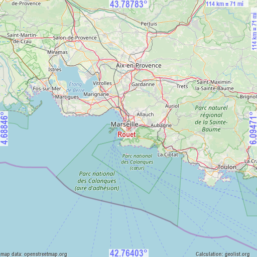
Rouet GPS coordinates[2]
43° 16' 41.088" North, 5° 23' 29.688" East
| Map corner | latitude | longitude |
|---|---|---|
| Upper-left | 43.78783°, | 4.68846° |
| Center: | 43.27808°, | 5.39158° |
| Lower-right: | 42.76403°, | 6.09471° |
| Map W x H: | 113.8×113.8 km | = 70.7×70.7mi |
| max Lat: | 51.07786° ⇑96.2% North |
| Rouet: | 43.27808° |
| min Lat: | ⇓3.8% South 41.3874° |
| min Long | Rouet | max Long |
| -5.08615° | 5.39158° | 9.52242° |
| W 81.8%⇐ | ⇒18.2% E |
Elevation
Elevation of Rouet is 19 m = 62 ft, and this is 174.7 m = 573 ft below average elevation for this country.
| Max E: |
2333 m = 7654 ft | 94.4% |
| Avg. | 193.7 m = 635 ft | |
| Rouet | 19 m = 62 ft | |
Min E: |
-1 m = -3 ft | 5.6% |
See also: France elevation on elevation.city.
Geographical zone
Rouet is located in North temperate zone (between Tropic of Cancer and the Arctic Circle). Distance of this Northern Tropic circle is 2206.2 km =1370.9 mi to South.| Distance of | km | miles | from Rouet |
|---|---|---|---|
| North Pole | 5195 | 3228 | to North |
| Arctic Circle | 2589.1 | 1608.8 | to North |
| Tropic Cancer | 2206.2 | 1370.9 | to South |
| Equator | 4812.1 | 2990.1 | to South |


Nearby cities:
15 places around Rouet: (largest is in red/bold)
• Baille
1.2 km =0.7 mi,  26°
26°
• Castellane
1.1 km =0.7 mi,  320°
320°
• La Capelette
1.2 km =0.7 mi,  75°
75°
• La Conception
1.5 km =0.9 mi,  7°
7°
• Le Camas
1.9 km =1.2 mi, 6°
• Lodi
1 km =0.6 mi,  346°
346°
• Marseille 06
1.5 km =0.9 mi, 316°
• Marseille 08
1.1 km =0.7 mi,  223°
223°
• Marseille Prefecture
1.8 km =1.1 mi, 324°
• Marseille Vauban
1.5 km =0.9 mi,  296°
296°
• Menpenti
0.6 km =0.4 mi,  39°
39°
• Notre-Dame du Mont
1.8 km =1.1 mi,  334°
334°
• Palais de Justice
1.6 km =1 mi,  306°
306°
• Périer
1 km =0.6 mi,  266°
266°
• Saint-Giniez
1.1 km =0.7 mi,  206°
206°
Sources, notices
• [Note1] Compared only with cities in France existing in our database
• [Src1] Map data: © OpenStreetMap contributors (CC-BY-SA)
• [Src2] Other city data from geonames.org with taken over terms of usage.
• [Src3] Geographical zone / Annual Mean Temperature by Robert A. Rohde @ Wikipedia
