Yeovil geodata
Yeovil (England) is a populated place; located in United Kingdom in Europe/London (GMT+1) time zone. With population of 45,784 people, there are 260 cities with bigger population in this country. Compared to other cities in United Kingdom, 92.4% of cities are located further ↑North; 67.4% of cities are located further →East and 53.7% of cities have higher elevation than Yeovil. Note1
Administrative division(s):
- Level 1: England
- Level 2: Somerset
- Level 3: South Somerset District
- Level 4: Yeovil


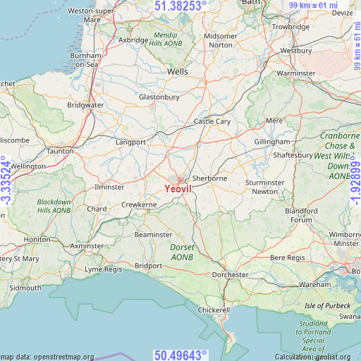
Yeovil GPS coordinates[2]
50° 56' 29.724" North, 2° 37' 55.596" West
| Map corner | latitude | longitude |
|---|---|---|
| Upper-left | 51.38253°, | -3.33524° |
| Center: | 50.94159°, | -2.63211° |
| Lower-right: | 50.49643°, | -1.92899° |
| Map W x H: | 98.5×98.5 km | = 61.2×61.2mi |
| max Lat: | 60.39635° ⇑92.4% North |
| Yeovil: | 50.94159° |
| min Lat: | ⇓7.6% South 34.60088° |
| min Long | Yeovil | max Long |
| -7.64133° | -2.63211° | 32.95536° |
| W 32.6%⇐ | ⇒67.4% E |
Elevation
Elevation of Yeovil is 55 m = 180 ft, and this is 17.9 m = 59 ft below average elevation for this country.
| Max E: |
515 m = 1690 ft | 53.7% |
| Avg. | 72.9 m = 239 ft | |
| Yeovil | 55 m = 180 ft | |
Min E: |
-30 m = -98 ft | 46.3% |
See also: Yeovil elevation on elevation.city.
Geographical zone
Yeovil is located in North temperate zone (between Tropic of Cancer and the Arctic Circle). Distance of this North polar circle is 1737 km =1079.3 mi to North.| Distance of | km | miles | from Yeovil |
|---|---|---|---|
| North Pole | 4342.9 | 2698.6 | to North |
| Arctic Circle | 1737 | 1079.3 | to North |
| Tropic Cancer | 3058.3 | 1900.3 | to South |
| Equator | 5664.2 | 3519.6 | to South |


Nearby cities:
15 places around Yeovil: (largest is in red/bold)
• Bradford Abbas
3.6 km =2.2 mi,  118°
118°
• Chilthorne Domer
4.6 km =2.9 mi,  314°
314°
• Halstock
8.3 km =5.2 mi,  191°
191°
• Haselbury Plucknett
9.9 km =6.2 mi,  238°
238°
• Ilchester
7.9 km =4.9 mi,  334°
334°
• Marston Magna
7.3 km =4.5 mi,  27°
27°
• Montacute
6 km =3.7 mi,  278°
278°
• Odcombe
5 km =3.1 mi,  260°
260°
• Queen Camel
9.5 km =5.9 mi,  24°
24°
• Sherborne
8 km =5 mi,  86°
86°
• Stoke-sub-Hamdon
8.4 km =5.2 mi, 279°
• Tintinhull
6.7 km =4.2 mi,  301°
301°
• West Chinnock
9.2 km =5.7 mi,  253°
253°
• West Coker
4.6 km =2.9 mi, 237°
• Yetminster
6.3 km =3.9 mi,  144°
144°
Sources, notices
• [Note1] Compared only with cities in United Kingdom existing in our database
• [Src1] Map data: © OpenStreetMap contributors (CC-BY-SA)
• [Src2] Other city data from geonames.org with taken over terms of usage.
• [Src3] Geographical zone / Annual Mean Temperature by Robert A. Rohde @ Wikipedia
