West Linton geodata
West Linton (Scotland) is a populated place; located in United Kingdom in Europe/London (GMT+1) time zone. With population of 1,530 people, there are 3015 cities with bigger population in this country. Compared to other cities in United Kingdom, 90.3% of cities are located further ↓South; 80.2% of cities are located further →East and 98.5% of cities have lower elevation than West Linton. Note1


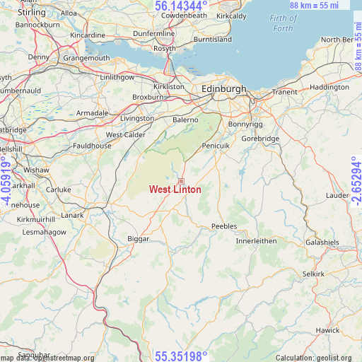
West Linton GPS coordinates[2]
55° 44' 58.992" North, 3° 21' 21.852" West
| Map corner | latitude | longitude |
|---|---|---|
| Upper-left | 56.14344°, | -4.05919° |
| Center: | 55.74972°, | -3.35607° |
| Lower-right: | 55.35198°, | -2.65294° |
| Map W x H: | 88×88 km | = 54.7×54.7mi |
| max Lat: | 60.39635° ⇑9.7% North |
| West Linton: | 55.74972° |
| min Lat: | ⇓90.3% South 34.60088° |
| min Long | West Linton | max Long |
| -7.64133° | -3.35607° | 32.95536° |
| W 19.8%⇐ | ⇒80.2% E |
Elevation
Elevation of West Linton is 235 m = 771 ft, and this is 162.1 m = 532 ft above average elevation for this country.
| Max E: |
515 m = 1690 ft | 1.5% |
| West Linton | 235 m 771 ft | |
| Avg. | 72.9 m = 239 ft | |
Min E: |
-30 m = -98 ft | 98.5% |
See also: United Kingdom elevation on elevation.city.
Geographical zone
West Linton is located in North temperate zone (between Tropic of Cancer and the Arctic Circle). Distance of this North polar circle is 1202.4 km =747.1 mi to North.| Distance of | km | miles | from West Linton |
|---|---|---|---|
| North Pole | 3808.3 | 2366.4 | to North |
| Arctic Circle | 1202.4 | 747.1 | to North |
| Tropic Cancer | 3592.9 | 2232.5 | to South |
| Equator | 6198.8 | 3851.8 | to South |


Nearby cities:
15 places around West Linton: (largest is in red/bold)
• Balerno
15 km =9.3 mi,  3°
3°
• Biggar
17.6 km =10.9 mi,  216°
216°
• Bilston
17.4 km =10.8 mi,  39°
39°
• Carnwath
17.8 km =11.1 mi,  251°
251°
• Colinton
18.6 km =11.6 mi,  19°
19°
• Currie
16.6 km =10.3 mi,  10°
10°
• East Calder
17.2 km =10.7 mi,  336°
336°
• Kirknewton
15.8 km =9.8 mi,  345°
345°
• Mid Calder
17.7 km =11 mi,  334°
334°
• Peebles
15.1 km =9.4 mi,  136°
136°
• Penicuik
12.2 km =7.6 mi, 41°
• Polbeth
17.3 km =10.7 mi,  315°
315°
• Rosewell
17.7 km =11 mi,  50°
50°
• Roslin
16.7 km =10.4 mi, 44°
• West Calder
17.5 km =10.9 mi,  310°
310°
Sources, notices
• [Note1] Compared only with cities in United Kingdom existing in our database
• [Src1] Map data: © OpenStreetMap contributors (CC-BY-SA)
• [Src2] Other city data from geonames.org with taken over terms of usage.
• [Src3] Geographical zone / Annual Mean Temperature by Robert A. Rohde @ Wikipedia
