Warrington geodata
Warrington (England) is a seat of a second-order administrative division; located in United Kingdom in Europe/London (GMT+0) time zone. With population of 165,456 people, there are 51 cities with bigger population in this country. Compared to other cities in United Kingdom, 67.7% of cities are located further ↓South; 66.6% of cities are located further →East and 85.8% of cities have higher elevation than Warrington. Note1


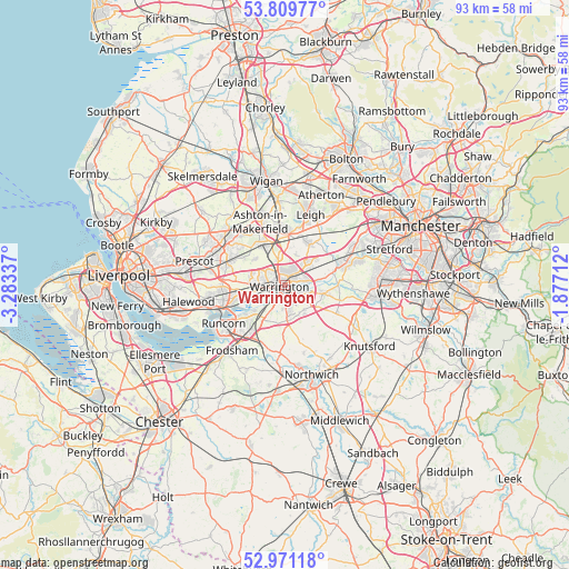
Warrington GPS coordinates[2]
53° 23' 33.144" North, 2° 34' 48.864" West
| Map corner | latitude | longitude |
|---|---|---|
| Upper-left | 53.80977°, | -3.28337° |
| Center: | 53.39254°, | -2.58024° |
| Lower-right: | 52.97118°, | -1.87712° |
| Map W x H: | 93.2×93.2 km | = 57.9×57.9mi |
| max Lat: | 60.39635° ⇑32.3% North |
| Warrington: | 53.39254° |
| min Lat: | ⇓67.7% South 34.60088° |
| min Long | Warrington | max Long |
| -7.64133° | -2.58024° | 32.95536° |
| W 33.4%⇐ | ⇒66.6% E |
Elevation
Elevation of Warrington is 15 m = 49 ft, and this is 57.9 m = 190 ft below average elevation for this country.
| Max E: |
515 m = 1690 ft | 85.8% |
| Avg. | 72.9 m = 239 ft | |
| Warrington | 15 m = 49 ft | |
Min E: |
-30 m = -98 ft | 14.2% |
See also: Warrington elevation on elevation.city.
Geographical zone
Warrington is located in North temperate zone (between Tropic of Cancer and the Arctic Circle). Distance of this North polar circle is 1464.5 km =910 mi to North.| Distance of | km | miles | from Warrington |
|---|---|---|---|
| North Pole | 4070.4 | 2529.2 | to North |
| Arctic Circle | 1464.5 | 910 | to North |
| Tropic Cancer | 3330.8 | 2069.7 | to South |
| Equator | 5936.7 | 3688.9 | to South |


Nearby cities:
15 places around Warrington: (largest is in red/bold)
• Appleton
4.5 km =2.8 mi,  172°
172°
• Appleton Thorn
5.2 km =3.2 mi,  153°
153°
• Burtonwood
6.6 km =4.1 mi,  308°
308°
• Croft
5 km =3.1 mi,  23°
23°
• Culcheth
7.6 km =4.7 mi,  31°
31°
• Daresbury
6.7 km =4.2 mi,  212°
212°
• Golborne
9.4 km =5.8 mi,  353°
353°
• Grappenhall
3.2 km =2 mi,  135°
135°
• Great Sankey
4 km =2.5 mi,  269°
269°
• High Legh
9.6 km =6 mi,  118°
118°
• Lymm
6.9 km =4.3 mi,  100°
100°
• Newton-le-Willows
6.5 km =4 mi, 348°
• Stockton Heath
2.4 km =1.5 mi, 170°
• Stretton
6.6 km =4.1 mi, 172°
• Winwick
4.7 km =2.9 mi,  343°
343°
Sources, notices
• [Note1] Compared only with cities in United Kingdom existing in our database
• [Src1] Map data: © OpenStreetMap contributors (CC-BY-SA)
• [Src2] Other city data from geonames.org with taken over terms of usage.
• [Src3] Geographical zone / Annual Mean Temperature by Robert A. Rohde @ Wikipedia
