Waltham on the Wolds geodata
Waltham on the Wolds (England) is a populated place; located in United Kingdom in Europe/London (GMT+1) time zone. With population of 836 people, there are 3959 cities with bigger population in this country. Compared to other cities in United Kingdom, 57.7% of cities are located further ↓South; 70.1% of cities are located further ←West and 94.1% of cities have lower elevation than Waltham on the Wolds. Note1
Administrative division(s):
- Level 1: England
- Level 2: Leicestershire
- Level 3: Melton District
- Level 4: Waltham on the Wolds and Thorpe Arnold


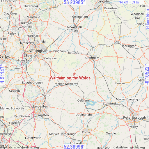
Waltham on the Wolds GPS coordinates[2]
52° 49' 1.128" North, 0° 48' 30.06" West
| Map corner | latitude | longitude |
|---|---|---|
| Upper-left | 53.23985°, | -1.51147° |
| Center: | 52.81698°, | -0.80835° |
| Lower-right: | 52.38996°, | -0.10522° |
| Map W x H: | 94.5×94.5 km | = 58.7×58.7mi |
| max Lat: | 60.39635° ⇑42.3% North |
| Waltham on the Wolds: | 52.81698° |
| min Lat: | ⇓57.7% South 34.60088° |
| min Long | Waltham on the | max Long |
| -7.64133° | -0.80835° | 32.95536° |
| W 70.1%⇐ | ⇒29.9% E |
Elevation
Elevation of Waltham on the Wolds is 175 m = 574 ft, and this is 102.1 m = 335 ft above average elevation for this country.
| Max E: |
515 m = 1690 ft | 5.9% |
| Waltham on the Wolds | 175 m 574 ft | |
| Avg. | 72.9 m = 239 ft | |
Min E: |
-30 m = -98 ft | 94.1% |
See also: United Kingdom elevation on elevation.city.
Geographical zone
Waltham on the Wolds is located in North temperate zone (between Tropic of Cancer and the Arctic Circle). Distance of this North polar circle is 1528.5 km =949.8 mi to North.| Distance of | km | miles | from Waltham on the Wolds |
|---|---|---|---|
| North Pole | 4134.4 | 2569 | to North |
| Arctic Circle | 1528.5 | 949.8 | to North |
| Tropic Cancer | 3266.8 | 2029.9 | to South |
| Equator | 5872.7 | 3649.1 | to South |


Nearby cities:
15 places around Waltham on the Wolds: (largest is in red/bold)
• Asfordby
11.7 km =7.3 mi,  239°
239°
• Ashwell
13 km =8.1 mi,  152°
152°
• Colsterworth
12.7 km =7.9 mi,  95°
95°
• Croxton Kerrial
5.3 km =3.3 mi,  36°
36°
• Great Dalby
12.2 km =7.6 mi,  210°
210°
• Grimston
12.3 km =7.6 mi,  255°
255°
• Harby
8.6 km =5.3 mi,  316°
316°
• Harlaxton
11 km =6.8 mi,  47°
47°
• Hose
7.8 km =4.8 mi,  304°
304°
• Long Clawson
8.4 km =5.2 mi,  285°
285°
• Market Overton
12 km =7.5 mi,  136°
136°
• Melton Mowbray
7.8 km =4.8 mi,  222°
222°
• South Witham
13.4 km =8.3 mi,  115°
115°
• Stathern
6.9 km =4.3 mi,  332°
332°
• Wymondham
7.8 km =4.8 mi, 144°
Sources, notices
• [Note1] Compared only with cities in United Kingdom existing in our database
• [Src1] Map data: © OpenStreetMap contributors (CC-BY-SA)
• [Src2] Other city data from geonames.org with taken over terms of usage.
• [Src3] Geographical zone / Annual Mean Temperature by Robert A. Rohde @ Wikipedia
