Wallsend geodata
Wallsend (England) is a seat of a second-order administrative division; located in United Kingdom in Europe/London (GMT+0) time zone. With population of 42,739 people, there are 281 cities with bigger population in this country. Compared to other cities in United Kingdom, 86.6% of cities are located further ↓South; 54.7% of cities are located further ←West and 72.3% of cities have higher elevation than Wallsend. Note1


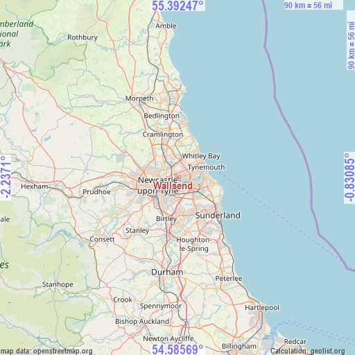
Wallsend GPS coordinates[2]
54° 59' 27.996" North, 1° 32' 2.292" West
| Map corner | latitude | longitude |
|---|---|---|
| Upper-left | 55.39247°, | -2.2371° |
| Center: | 54.99111°, | -1.53397° |
| Lower-right: | 54.58569°, | -0.83085° |
| Map W x H: | 89.7×89.7 km | = 55.7×55.7mi |
| max Lat: | 60.39635° ⇑13.4% North |
| Wallsend: | 54.99111° |
| min Lat: | ⇓86.6% South 34.60088° |
| min Long | Wallsend | max Long |
| -7.64133° | -1.53397° | 32.95536° |
| W 54.7%⇐ | ⇒45.3% E |
Elevation
Elevation of Wallsend is 30 m = 98 ft, and this is 42.9 m = 141 ft below average elevation for this country.
| Max E: |
515 m = 1690 ft | 72.3% |
| Avg. | 72.9 m = 239 ft | |
| Wallsend | 30 m = 98 ft | |
Min E: |
-30 m = -98 ft | 27.7% |
See also: Wallsend elevation on elevation.city.
Geographical zone
Wallsend is located in North temperate zone (between Tropic of Cancer and the Arctic Circle). Distance of this North polar circle is 1286.7 km =799.5 mi to North.| Distance of | km | miles | from Wallsend |
|---|---|---|---|
| North Pole | 3892.6 | 2418.7 | to North |
| Arctic Circle | 1286.7 | 799.5 | to North |
| Tropic Cancer | 3508.5 | 2180.1 | to South |
| Equator | 6114.4 | 3799.3 | to South |


Nearby cities:
15 places around Wallsend: (largest is in red/bold)
• Backworth
5.7 km =3.5 mi,  3°
3°
• Felling
4.9 km =3 mi,  209°
209°
• Gateshead
5.4 km =3.4 mi,  233°
233°
• Gosforth
5.4 km =3.4 mi,  280°
280°
• Hebburn
2.3 km =1.4 mi,  149°
149°
• Jarrow
3.4 km =2.1 mi,  110°
110°
• Newcastle upon Tyne
5.5 km =3.4 mi,  248°
248°
• North Shields
6.1 km =3.8 mi,  62°
62°
• Seghill
8 km =5 mi,  352°
352°
• Shiremoor
5.2 km =3.2 mi,  17°
17°
• South Shields
6.5 km =4 mi,  82°
82°
• The Boldons
7.4 km =4.6 mi,  136°
136°
• Tynemouth
7.5 km =4.7 mi,  66°
66°
• Whitley Bay
7.7 km =4.8 mi,  45°
45°
• Wideopen
8.2 km =5.1 mi,  316°
316°
Sources, notices
• [Note1] Compared only with cities in United Kingdom existing in our database
• [Src1] Map data: © OpenStreetMap contributors (CC-BY-SA)
• [Src2] Other city data from geonames.org with taken over terms of usage.
• [Src3] Geographical zone / Annual Mean Temperature by Robert A. Rohde @ Wikipedia
