Ullapool geodata
Ullapool (Scotland) is a populated place; located in United Kingdom in Europe/London (GMT+0) time zone. With population of 1,510 people, there are 3037 cities with bigger population in this country. Compared to other cities in United Kingdom, 99.7% of cities are located further ↓South; 96.9% of cities are located further →East and 84.7% of cities have higher elevation than Ullapool. Note1


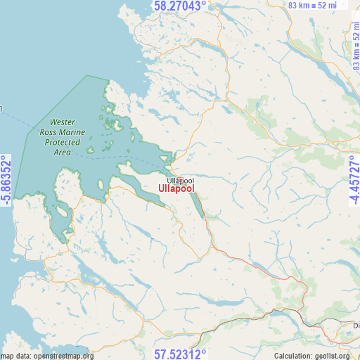
Ullapool GPS coordinates[2]
57° 53' 55.392" North, 5° 9' 37.404" West
| Map corner | latitude | longitude |
|---|---|---|
| Upper-left | 58.27043°, | -5.86352° |
| Center: | 57.89872°, | -5.16039° |
| Lower-right: | 57.52312°, | -4.45727° |
| Map W x H: | 83.1×83.1 km | = 51.6×51.6mi |
| max Lat: | 60.39635° ⇑0.3% North |
| Ullapool: | 57.89872° |
| min Lat: | ⇓99.7% South 34.60088° |
| min Long | Ullapool | max Long |
| -7.64133° | -5.16039° | 32.95536° |
| W 3.1%⇐ | ⇒96.9% E |
Elevation
Elevation of Ullapool is 16 m = 52 ft, and this is 56.9 m = 187 ft below average elevation for this country.
| Max E: |
515 m = 1690 ft | 84.7% |
| Avg. | 72.9 m = 239 ft | |
| Ullapool | 16 m = 52 ft | |
Min E: |
-30 m = -98 ft | 15.3% |
See also: United Kingdom elevation on elevation.city.
Geographical zone
Ullapool is located in North temperate zone (between Tropic of Cancer and the Arctic Circle). Distance of this North polar circle is 963.4 km =598.6 mi to North.| Distance of | km | miles | from Ullapool |
|---|---|---|---|
| North Pole | 3569.3 | 2217.9 | to North |
| Arctic Circle | 963.4 | 598.6 | to North |
| Tropic Cancer | 3831.8 | 2381 | to South |
| Equator | 6437.7 | 4000.2 | to South |


Nearby cities:
15 places around Ullapool: (largest is in red/bold)
• Alness
58.2 km =36.2 mi,  112°
112°
• Avoch
68.9 km =42.8 mi,  122°
122°
• Beauly
62.1 km =38.6 mi,  138°
138°
• Conon Bridge
56.7 km =35.2 mi,  130°
130°
• Dingwall
55.1 km =34.2 mi, 127°
• Dornoch
66.9 km =41.6 mi,  91°
91°
• Evanton
55.2 km =34.3 mi, 118°
• Golspie
70.3 km =43.7 mi,  83°
83°
• Invergordon
63.3 km =39.3 mi, 111°
• Kirkhill
64.6 km =40.1 mi, 136°
• Maryburgh
55.9 km =34.7 mi, 130°
• Muir of Ord
59.2 km =36.8 mi, 135°
• North Kessock
69.9 km =43.4 mi, 129°
• Strathpeffer
50.6 km =31.4 mi, 133°
• Tain
65.9 km =40.9 mi,  98°
98°
Sources, notices
• [Note1] Compared only with cities in United Kingdom existing in our database
• [Src1] Map data: © OpenStreetMap contributors (CC-BY-SA)
• [Src2] Other city data from geonames.org with taken over terms of usage.
• [Src3] Geographical zone / Annual Mean Temperature by Robert A. Rohde @ Wikipedia
