Shrewsbury geodata
Shrewsbury (England) is a seat of a second-order administrative division; located in United Kingdom in Europe/London (GMT+0) time zone. With population of 71,715 people, there are 147 cities with bigger population in this country. Compared to other cities in United Kingdom, 55.4% of cities are located further ↓South; 69.9% of cities are located further →East and 59% of cities have lower elevation than Shrewsbury. Note1


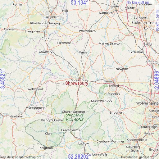
Shrewsbury GPS coordinates[2]
52° 42' 36.324" North, 2° 45' 7.488" West
| Map corner | latitude | longitude |
|---|---|---|
| Upper-left | 53.134°, | -3.45521° |
| Center: | 52.71009°, | -2.75208° |
| Lower-right: | 52.28202°, | -2.04896° |
| Map W x H: | 94.7×94.7 km | = 58.8×58.8mi |
| max Lat: | 60.39635° ⇑44.6% North |
| Shrewsbury: | 52.71009° |
| min Lat: | ⇓55.4% South 34.60088° |
| min Long | Shrewsbury | max Long |
| -7.64133° | -2.75208° | 32.95536° |
| W 30.1%⇐ | ⇒69.9% E |
Elevation
Elevation of Shrewsbury is 75 m = 246 ft, and this is 2.1 m = 7 ft above average elevation for this country.
| Max E: |
515 m = 1690 ft | 41% |
| Shrewsbury | 75 m 246 ft | |
| Avg. | 72.9 m = 239 ft | |
Min E: |
-30 m = -98 ft | 59% |
See also: Shrewsbury elevation on elevation.city.
Geographical zone
Shrewsbury is located in North temperate zone (between Tropic of Cancer and the Arctic Circle). Distance of this North polar circle is 1540.4 km =957.2 mi to North.| Distance of | km | miles | from Shrewsbury |
|---|---|---|---|
| North Pole | 4146.2 | 2576.3 | to North |
| Arctic Circle | 1540.4 | 957.2 | to North |
| Tropic Cancer | 3254.9 | 2022.5 | to South |
| Equator | 5860.8 | 3641.7 | to South |


Nearby cities:
15 places around Shrewsbury: (largest is in red/bold)
• Acton Burnell
11.4 km =7.1 mi,  160°
160°
• Astley
7.2 km =4.5 mi,  29°
29°
• Baschurch
11 km =6.8 mi,  322°
322°
• Bayston Hill
3.9 km =2.4 mi,  189°
189°
• Berrington
7.5 km =4.7 mi,  152°
152°
• Bicton
4.8 km =3 mi,  295°
295°
• Clive
11.6 km =7.2 mi,  9°
9°
• Condover
6.9 km =4.3 mi,  178°
178°
• Dorrington
9.9 km =6.2 mi, 188°
• Ford
7.9 km =4.9 mi,  275°
275°
• Great Hanwood
5.3 km =3.3 mi,  235°
235°
• Great Ness
11.1 km =6.9 mi, 302°
• High Ercall
11.2 km =7 mi,  64°
64°
• Shawbury
10.9 km =6.8 mi, 34°
• Withington
10.3 km =6.4 mi,  85°
85°
Sources, notices
• [Note1] Compared only with cities in United Kingdom existing in our database
• [Src1] Map data: © OpenStreetMap contributors (CC-BY-SA)
• [Src2] Other city data from geonames.org with taken over terms of usage.
• [Src3] Geographical zone / Annual Mean Temperature by Robert A. Rohde @ Wikipedia
