Saint Monans geodata
Saint Monans (Scotland) is a populated place; located in United Kingdom in Europe/London (GMT+1) time zone. With population of 1,230 people, there are 3318 cities with bigger population in this country. Compared to other cities in United Kingdom, 95.7% of cities are located further ↓South; 70.3% of cities are located further →East and 82% of cities have higher elevation than Saint Monans. Note1


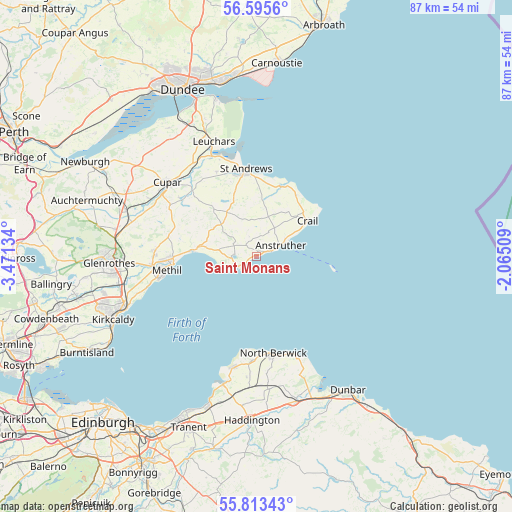
Saint Monans GPS coordinates[2]
56° 12' 23.436" North, 2° 46' 5.556" West
| Map corner | latitude | longitude |
|---|---|---|
| Upper-left | 56.5956°, | -3.47134° |
| Center: | 56.20651°, | -2.76821° |
| Lower-right: | 55.81343°, | -2.06509° |
| Map W x H: | 87×87 km | = 54.1×54.1mi |
| max Lat: | 60.39635° ⇑4.3% North |
| Saint Monans: | 56.20651° |
| min Lat: | ⇓95.7% South 34.60088° |
| min Long | Saint Monans | max Long |
| -7.64133° | -2.76821° | 32.95536° |
| W 29.7%⇐ | ⇒70.3% E |
Elevation
Elevation of Saint Monans is 19 m = 62 ft, and this is 53.9 m = 177 ft below average elevation for this country.
| Max E: |
515 m = 1690 ft | 82% |
| Avg. | 72.9 m = 239 ft | |
| Saint Monans | 19 m = 62 ft | |
Min E: |
-30 m = -98 ft | 18% |
See also: United Kingdom elevation on elevation.city.
Geographical zone
Saint Monans is located in North temperate zone (between Tropic of Cancer and the Arctic Circle). Distance of this North polar circle is 1151.6 km =715.6 mi to North.| Distance of | km | miles | from Saint Monans |
|---|---|---|---|
| North Pole | 3757.5 | 2334.8 | to North |
| Arctic Circle | 1151.6 | 715.6 | to North |
| Tropic Cancer | 3643.7 | 2264.1 | to South |
| Equator | 6249.6 | 3883.3 | to South |


Nearby cities:
15 places around Saint Monans: (largest is in red/bold)
• Anstruther
4.5 km =2.8 mi,  65°
65°
• Buckhaven
16.9 km =10.5 mi,  256°
256°
• Ceres
16 km =9.9 mi,  307°
307°
• Crail
10.6 km =6.6 mi,  55°
55°
• East Wemyss
19 km =11.8 mi,  254°
254°
• Elie
3.7 km =2.3 mi, 245°
• Kennoway
17.4 km =10.8 mi,  271°
271°
• Leven
14.4 km =8.9 mi, 267°
• Lundin Links
11.4 km =7.1 mi, 273°
• Methil
15.8 km =9.8 mi, 261°
• North Berwick
16.7 km =10.4 mi,  170°
170°
• Pittenweem
2.6 km =1.6 mi, 71°
• Saint Andrews
14.8 km =9.2 mi,  352°
352°
• Strathkinness
15.8 km =9.8 mi,  335°
335°
• Windygates
17.6 km =10.9 mi, 266°
Sources, notices
• [Note1] Compared only with cities in United Kingdom existing in our database
• [Src1] Map data: © OpenStreetMap contributors (CC-BY-SA)
• [Src2] Other city data from geonames.org with taken over terms of usage.
• [Src3] Geographical zone / Annual Mean Temperature by Robert A. Rohde @ Wikipedia
