Ruyton-XI-Towns geodata
Ruyton-XI-Towns (England) is a populated place; located in United Kingdom in Europe/London (GMT+1) time zone. With population of 1,040 people, there are 3571 cities with bigger population in this country. Compared to other cities in United Kingdom, 57.3% of cities are located further ↓South; 73.2% of cities are located further →East and 61.1% of cities have lower elevation than Ruyton-XI-Towns. Note1


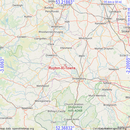
Ruyton-XI-Towns GPS coordinates[2]
52° 47' 43.98" North, 2° 54' 11.448" West
| Map corner | latitude | longitude |
|---|---|---|
| Upper-left | 53.21863°, | -3.6063° |
| Center: | 52.79555°, | -2.90318° |
| Lower-right: | 52.36832°, | -2.20005° |
| Map W x H: | 94.5×94.5 km | = 58.7×58.7mi |
| max Lat: | 60.39635° ⇑42.7% North |
| Ruyton-XI-Towns: | 52.79555° |
| min Lat: | ⇓57.3% South 34.60088° |
| min Long | Ruyton-XI-Towns | max Long |
| -7.64133° | -2.90318° | 32.95536° |
| W 26.8%⇐ | ⇒73.2% E |
Elevation
Elevation of Ruyton-XI-Towns is 78 m = 256 ft, and this is 5.1 m = 17 ft above average elevation for this country.
| Max E: |
515 m = 1690 ft | 38.9% |
| Ruyton-XI-Towns | 78 m 256 ft | |
| Avg. | 72.9 m = 239 ft | |
Min E: |
-30 m = -98 ft | 61.1% |
See also: United Kingdom elevation on elevation.city.
Geographical zone
Ruyton-XI-Towns is located in North temperate zone (between Tropic of Cancer and the Arctic Circle). Distance of this North polar circle is 1530.9 km =951.3 mi to North.| Distance of | km | miles | from Ruyton-XI-Towns |
|---|---|---|---|
| North Pole | 4136.7 | 2570.4 | to North |
| Arctic Circle | 1530.9 | 951.3 | to North |
| Tropic Cancer | 3264.4 | 2028.4 | to South |
| Equator | 5870.3 | 3647.6 | to South |


Nearby cities:
15 places around Ruyton-XI-Towns: (largest is in red/bold)
• Baschurch
3.5 km =2.2 mi,  103°
103°
• Bicton
9.5 km =5.9 mi,  142°
142°
• Clive
12.3 km =7.6 mi,  80°
80°
• Cockshutt
8.1 km =5 mi,  32°
32°
• Ellesmere
12.6 km =7.8 mi,  1°
1°
• Ford
9 km =5.6 mi,  165°
165°
• Four Crosses
12.6 km =7.8 mi,  251°
251°
• Great Ness
3.6 km =2.2 mi, 167°
• Llanymynech
12.6 km =7.8 mi,  262°
262°
• Oswestry
12.6 km =7.8 mi,  305°
305°
• Pant
11.9 km =7.4 mi,  267°
267°
• Petton
6.3 km =3.9 mi,  48°
48°
• West Felton
5.7 km =3.5 mi,  304°
304°
• Westbury
13.5 km =8.4 mi,  194°
194°
• Whittington
10.9 km =6.8 mi,  322°
322°
Sources, notices
• [Note1] Compared only with cities in United Kingdom existing in our database
• [Src1] Map data: © OpenStreetMap contributors (CC-BY-SA)
• [Src2] Other city data from geonames.org with taken over terms of usage.
• [Src3] Geographical zone / Annual Mean Temperature by Robert A. Rohde @ Wikipedia
