Rotherham geodata
Rotherham (England) is a seat of a second-order administrative division; located in United Kingdom in Europe/London (GMT+1) time zone. With population of 117,618 people, there are 80 cities with bigger population in this country. Compared to other cities in United Kingdom, 68.3% of cities are located further ↓South; 58.7% of cities are located further ←West and 64% of cities have higher elevation than Rotherham. Note1


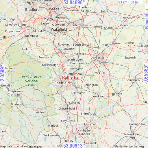
Rotherham GPS coordinates[2]
53° 25' 48.432" North, 1° 21' 24.408" West
| Map corner | latitude | longitude |
|---|---|---|
| Upper-left | 53.84698°, | -2.0599° |
| Center: | 53.43012°, | -1.35678° |
| Lower-right: | 53.00913°, | -0.65365° |
| Map W x H: | 93.2×93.2 km | = 57.9×57.9mi |
| max Lat: | 60.39635° ⇑31.7% North |
| Rotherham: | 53.43012° |
| min Lat: | ⇓68.3% South 34.60088° |
| min Long | Rotherham | max Long |
| -7.64133° | -1.35678° | 32.95536° |
| W 58.7%⇐ | ⇒41.3% E |
Elevation
Elevation of Rotherham is 41 m = 135 ft, and this is 31.9 m = 105 ft below average elevation for this country.
| Max E: |
515 m = 1690 ft | 64% |
| Avg. | 72.9 m = 239 ft | |
| Rotherham | 41 m = 135 ft | |
Min E: |
-30 m = -98 ft | 36% |
See also: Rotherham elevation on elevation.city.
Geographical zone
Rotherham is located in North temperate zone (between Tropic of Cancer and the Arctic Circle). Distance of this North polar circle is 1460.3 km =907.4 mi to North.| Distance of | km | miles | from Rotherham |
|---|---|---|---|
| North Pole | 4066.2 | 2526.6 | to North |
| Arctic Circle | 1460.3 | 907.4 | to North |
| Tropic Cancer | 3335 | 2072.3 | to South |
| Equator | 5940.9 | 3691.5 | to South |


Nearby cities:
15 places around Rotherham: (largest is in red/bold)
• Bramley
6.2 km =3.9 mi,  104°
104°
• Burngreave
7.9 km =4.9 mi,  238°
238°
• Catcliffe
4.1 km =2.5 mi,  184°
184°
• Chapeltown
8.6 km =5.3 mi,  296°
296°
• Hellaby
7.7 km =4.8 mi, 96°
• Hoyland Nether
9.9 km =6.2 mi,  321°
321°
• Mexborough
8.3 km =5.2 mi,  30°
30°
• Orgreave
5.2 km =3.2 mi,  187°
187°
• Rawmarsh
3.5 km =2.2 mi,  13°
13°
• Sheffield
8.9 km =5.5 mi,  234°
234°
• Treeton
5 km =3.1 mi, 176°
• Ulley
6.5 km =4 mi,  145°
145°
• Wath upon Dearne
8.1 km =5 mi, 5°
• Wentworth
6.6 km =4.1 mi, 324°
• Whiston
3.7 km =2.3 mi,  131°
131°
Sources, notices
• [Note1] Compared only with cities in United Kingdom existing in our database
• [Src1] Map data: © OpenStreetMap contributors (CC-BY-SA)
• [Src2] Other city data from geonames.org with taken over terms of usage.
• [Src3] Geographical zone / Annual Mean Temperature by Robert A. Rohde @ Wikipedia
