Portavogie geodata
Portavogie (Northern Ireland) is a populated place; located in United Kingdom in Europe/London (GMT+1) time zone. With population of 1,639 people, there are 2915 cities with bigger population in this country. Compared to other cities in United Kingdom, 81.6% of cities are located further ↓South; 97.5% of cities are located further →East and 96.2% of cities have higher elevation than Portavogie. Note1


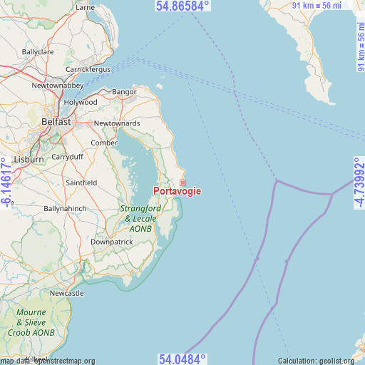
Portavogie GPS coordinates[2]
54° 27' 32.976" North, 5° 26' 34.944" West
| Map corner | latitude | longitude |
|---|---|---|
| Upper-left | 54.86584°, | -6.14617° |
| Center: | 54.45916°, | -5.44304° |
| Lower-right: | 54.0484°, | -4.73992° |
| Map W x H: | 90.9×90.9 km | = 56.5×56.5mi |
| max Lat: | 60.39635° ⇑18.4% North |
| Portavogie: | 54.45916° |
| min Lat: | ⇓81.6% South 34.60088° |
| min Long | Portavogie | max Long |
| -7.64133° | -5.44304° | 32.95536° |
| W 2.5%⇐ | ⇒97.5% E |
Elevation
Elevation of Portavogie is 7 m = 23 ft, and this is 65.9 m = 216 ft below average elevation for this country.
| Max E: |
515 m = 1690 ft | 96.2% |
| Avg. | 72.9 m = 239 ft | |
| Portavogie | 7 m = 23 ft | |
Min E: |
-30 m = -98 ft | 3.8% |
See also: United Kingdom elevation on elevation.city.
Geographical zone
Portavogie is located in North temperate zone (between Tropic of Cancer and the Arctic Circle). Distance of this North polar circle is 1345.9 km =836.3 mi to North.| Distance of | km | miles | from Portavogie |
|---|---|---|---|
| North Pole | 3951.8 | 2455.5 | to North |
| Arctic Circle | 1345.9 | 836.3 | to North |
| Tropic Cancer | 3449.4 | 2143.4 | to South |
| Equator | 6055.3 | 3762.6 | to South |


Nearby cities:
15 places around Portavogie: (largest is in red/bold)
• Ardglass
24.3 km =15.1 mi,  206°
206°
• Ballygowan
23 km =14.3 mi,  281°
281°
• Ballywalter
9.7 km =6 mi,  343°
343°
• Bangor
26 km =16.2 mi,  325°
325°
• Comber
21.9 km =13.6 mi,  297°
297°
• Crossgar
21.7 km =13.5 mi,  251°
251°
• Donaghadee
21.1 km =13.1 mi, 343°
• Downpatrick
22.9 km =14.2 mi,  230°
230°
• Greyabbey
11.3 km =7 mi,  318°
318°
• Killyleagh
14.7 km =9.1 mi,  244°
244°
• Kircubbin
6.7 km =4.2 mi, 298°
• Millisle
17.3 km =10.7 mi, 341°
• Newtownards
21.8 km =13.5 mi,  312°
312°
• Portaferry
10.9 km =6.8 mi,  217°
217°
• Saintfield
25.1 km =15.6 mi,  270°
270°
Sources, notices
• [Note1] Compared only with cities in United Kingdom existing in our database
• [Src1] Map data: © OpenStreetMap contributors (CC-BY-SA)
• [Src2] Other city data from geonames.org with taken over terms of usage.
• [Src3] Geographical zone / Annual Mean Temperature by Robert A. Rohde @ Wikipedia
