Nuneaton geodata
Nuneaton (England) is a populated place; located in United Kingdom in Europe/London (GMT+1) time zone. With population of 92,698 people, there are 105 cities with bigger population in this country. Compared to other cities in United Kingdom, 50.7% of cities are located further ↓South; 56.2% of cities are located further ←West and 64.5% of cities have lower elevation than Nuneaton. Note1
Administrative division(s):
- Level 1: England
- Level 2: Warwickshire
- Level 3: Nuneaton and Bedworth District


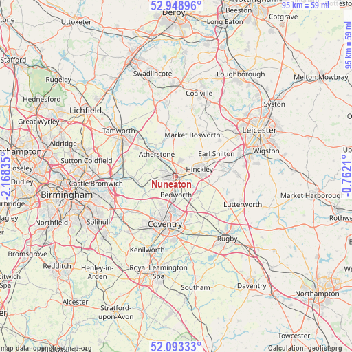
Nuneaton GPS coordinates[2]
52° 31' 23.628" North, 1° 27' 54.828" West
| Map corner | latitude | longitude |
|---|---|---|
| Upper-left | 52.94896°, | -2.16835° |
| Center: | 52.52323°, | -1.46523° |
| Lower-right: | 52.09333°, | -0.7621° |
| Map W x H: | 95.1×95.1 km | = 59.1×59.1mi |
| max Lat: | 60.39635° ⇑49.3% North |
| Nuneaton: | 52.52323° |
| min Lat: | ⇓50.7% South 34.60088° |
| min Long | Nuneaton | max Long |
| -7.64133° | -1.46523° | 32.95536° |
| W 56.2%⇐ | ⇒43.8% E |
Elevation
Elevation of Nuneaton is 85 m = 279 ft, and this is 12.1 m = 40 ft above average elevation for this country.
| Max E: |
515 m = 1690 ft | 35.5% |
| Nuneaton | 85 m 279 ft | |
| Avg. | 72.9 m = 239 ft | |
Min E: |
-30 m = -98 ft | 64.5% |
See also: Nuneaton elevation on elevation.city.
Geographical zone
Nuneaton is located in North temperate zone (between Tropic of Cancer and the Arctic Circle). Distance of this North polar circle is 1561.1 km =970 mi to North.| Distance of | km | miles | from Nuneaton |
|---|---|---|---|
| North Pole | 4167 | 2589.3 | to North |
| Arctic Circle | 1561.1 | 970 | to North |
| Tropic Cancer | 3234.1 | 2009.6 | to South |
| Equator | 5840 | 3628.8 | to South |


Nearby cities:
15 places around Nuneaton: (largest is in red/bold)
• Atherstone
8 km =5 mi,  316°
316°
• Attleborough
1.3 km =0.8 mi,  148°
148°
• Bedworth
4.9 km =3 mi,  183°
183°
• Earl Shilton
11.8 km =7.3 mi,  59°
59°
• Exhall
6.6 km =4.1 mi,  189°
189°
• Fillongley
9.4 km =5.8 mi,  241°
241°
• Hartshill
4.8 km =3 mi,  305°
305°
• Higham on the Hill
4.1 km =2.5 mi,  29°
29°
• Hinckley
6.3 km =3.9 mi,  73°
73°
• Keresley
9.2 km =5.7 mi,  210°
210°
• Market Bosworth
12 km =7.5 mi,  20°
20°
• Sapcote
12.7 km =7.9 mi,  83°
83°
• Sharnford
11.5 km =7.1 mi,  91°
91°
• Stoke Golding
6.4 km =4 mi, 34°
• Wolvey
7.7 km =4.8 mi,  122°
122°
Sources, notices
• [Note1] Compared only with cities in United Kingdom existing in our database
• [Src1] Map data: © OpenStreetMap contributors (CC-BY-SA)
• [Src2] Other city data from geonames.org with taken over terms of usage.
• [Src3] Geographical zone / Annual Mean Temperature by Robert A. Rohde @ Wikipedia
