Milton geodata
Milton (Scotland) is a populated place; located in United Kingdom in Europe/London (GMT+1) time zone. With population of 945 people, there are 3734 cities with bigger population in this country. Compared to other cities in United Kingdom, 98.1% of cities are located further ↓South; 93.2% of cities are located further →East and 53.7% of cities have higher elevation than Milton. Note1


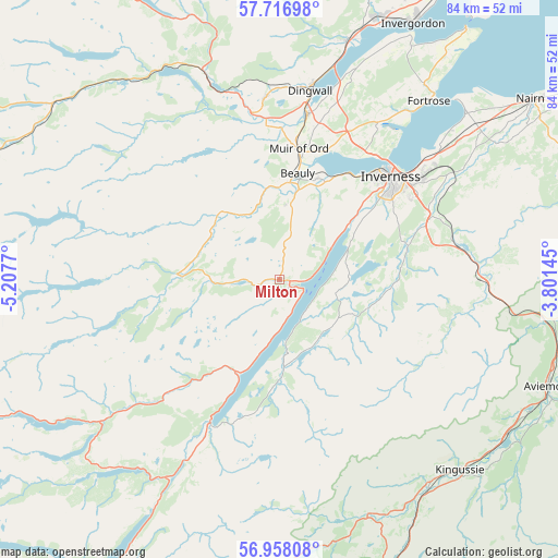
Milton GPS coordinates[2]
57° 20' 22.164" North, 4° 30' 16.452" West
| Map corner | latitude | longitude |
|---|---|---|
| Upper-left | 57.71698°, | -5.2077° |
| Center: | 57.33949°, | -4.50457° |
| Lower-right: | 56.95808°, | -3.80145° |
| Map W x H: | 84.4×84.4 km | = 52.4×52.4mi |
| max Lat: | 60.39635° ⇑1.9% North |
| Milton: | 57.33949° |
| min Lat: | ⇓98.1% South 34.60088° |
| min Long | Milton | max Long |
| -7.64133° | -4.50457° | 32.95536° |
| W 6.8%⇐ | ⇒93.2% E |
Elevation
Elevation of Milton is 55 m = 180 ft, and this is 17.9 m = 59 ft below average elevation for this country.
| Max E: |
515 m = 1690 ft | 53.7% |
| Avg. | 72.9 m = 239 ft | |
| Milton | 55 m = 180 ft | |
Min E: |
-30 m = -98 ft | 46.3% |
See also: United Kingdom elevation on elevation.city.
Geographical zone
Milton is located in North temperate zone (between Tropic of Cancer and the Arctic Circle). Distance of this North polar circle is 1025.6 km =637.3 mi to North.| Distance of | km | miles | from Milton |
|---|---|---|---|
| North Pole | 3631.5 | 2256.5 | to North |
| Arctic Circle | 1025.6 | 637.3 | to North |
| Tropic Cancer | 3769.6 | 2342.3 | to South |
| Equator | 6375.6 | 3961.6 | to South |


Nearby cities:
15 places around Milton: (largest is in red/bold)
• Beauly
16.2 km =10.1 mi,  9°
9°
• Conon Bridge
25.5 km =15.8 mi, 9°
• Culloden
27.2 km =16.9 mi,  52°
52°
• Drumnadrochit
1.6 km =1 mi,  110°
110°
• Fort Augustus
24.3 km =15.1 mi,  206°
206°
• Highland
23.2 km =14.4 mi, 45°
• Inverness
22.9 km =14.2 mi, 47°
• Kirkhill
16.2 km =10.1 mi,  19°
19°
• Maryburgh
26.4 km =16.4 mi, 8°
• Milton of Leys
23.3 km =14.5 mi,  57°
57°
• Muir of Ord
20.2 km =12.6 mi, 7°
• North Kessock
23.8 km =14.8 mi,  40°
40°
• Smithton
26.3 km =16.3 mi, 53°
• Strathpeffer
27.4 km =17 mi,  355°
355°
• Westhill
26 km =16.2 mi, 55°
Sources, notices
• [Note1] Compared only with cities in United Kingdom existing in our database
• [Src1] Map data: © OpenStreetMap contributors (CC-BY-SA)
• [Src2] Other city data from geonames.org with taken over terms of usage.
• [Src3] Geographical zone / Annual Mean Temperature by Robert A. Rohde @ Wikipedia
