Middleham geodata
Middleham (England) is a populated place; located in United Kingdom in Europe/London (GMT+1) time zone. With population of 825 people, there are 3986 cities with bigger population in this country. Compared to other cities in United Kingdom, 80.7% of cities are located further ↓South; 51.2% of cities are located further →East and 87.1% of cities have lower elevation than Middleham. Note1
Administrative division(s):
- Level 1: England
- Level 2: North Yorkshire
- Level 3: Richmondshire District
- Level 4: Middleham


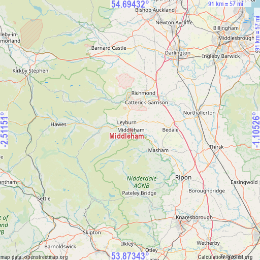
Middleham GPS coordinates[2]
54° 17' 9.312" North, 1° 48' 30.168" West
| Map corner | latitude | longitude |
|---|---|---|
| Upper-left | 54.69432°, | -2.51151° |
| Center: | 54.28592°, | -1.80838° |
| Lower-right: | 53.87343°, | -1.10526° |
| Map W x H: | 91.3×91.3 km | = 56.7×56.7mi |
| max Lat: | 60.39635° ⇑19.3% North |
| Middleham: | 54.28592° |
| min Lat: | ⇓80.7% South 34.60088° |
| min Long | Middleham | max Long |
| -7.64133° | -1.80838° | 32.95536° |
| W 48.8%⇐ | ⇒51.2% E |
Elevation
Elevation of Middleham is 139 m = 456 ft, and this is 66.1 m = 217 ft above average elevation for this country.
| Max E: |
515 m = 1690 ft | 12.9% |
| Middleham | 139 m 456 ft | |
| Avg. | 72.9 m = 239 ft | |
Min E: |
-30 m = -98 ft | 87.1% |
See also: United Kingdom elevation on elevation.city.
Geographical zone
Middleham is located in North temperate zone (between Tropic of Cancer and the Arctic Circle). Distance of this North polar circle is 1365.1 km =848.2 mi to North.| Distance of | km | miles | from Middleham |
|---|---|---|---|
| North Pole | 3971 | 2467.5 | to North |
| Arctic Circle | 1365.1 | 848.2 | to North |
| Tropic Cancer | 3430.1 | 2131.4 | to South |
| Equator | 6036 | 3750.6 | to South |


Nearby cities:
15 places around Middleham: (largest is in red/bold)
• Barningham
22.8 km =14.2 mi,  349°
349°
• Bedale
14.1 km =8.8 mi,  89°
89°
• Catterick
15.1 km =9.4 mi,  48°
48°
• Catterick Garrison
11.6 km =7.2 mi,  28°
28°
• East Cowton
23.8 km =14.8 mi, 49°
• Kirkby Malzeard
17.1 km =10.6 mi,  142°
142°
• Leyburn
3 km =1.9 mi,  331°
331°
• Masham
12.1 km =7.5 mi,  125°
125°
• Melsonby
22 km =13.7 mi,  19°
19°
• Middleton Tyas
20.7 km =12.9 mi, 29°
• North Cowton
22.6 km =14 mi,  44°
44°
• Pateley Bridge
22.4 km =13.9 mi,  171°
171°
• Reeth
14.3 km =8.9 mi,  321°
321°
• Richmond
13.9 km =8.6 mi, 20°
• Scorton
17.8 km =11.1 mi, 45°
Sources, notices
• [Note1] Compared only with cities in United Kingdom existing in our database
• [Src1] Map data: © OpenStreetMap contributors (CC-BY-SA)
• [Src2] Other city data from geonames.org with taken over terms of usage.
• [Src3] Geographical zone / Annual Mean Temperature by Robert A. Rohde @ Wikipedia
