Llandrindod Wells geodata
Llandrindod Wells (Wales) is a seat of a second-order administrative division; located in United Kingdom in Europe/London (GMT+1) time zone. With population of 5,309 people, there are 1584 cities with bigger population in this country. Compared to other cities in United Kingdom, 55.5% of cities are located further ↑North; 80.5% of cities are located further →East and 97.6% of cities have lower elevation than Llandrindod Wells. Note1


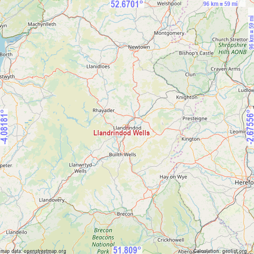
Llandrindod Wells GPS coordinates[2]
52° 14' 29.904" North, 3° 22' 43.248" West
| Map corner | latitude | longitude |
|---|---|---|
| Upper-left | 52.6701°, | -4.08181° |
| Center: | 52.24164°, | -3.37868° |
| Lower-right: | 51.809°, | -2.67556° |
| Map W x H: | 95.7×95.7 km | = 59.5×59.5mi |
| max Lat: | 60.39635° ⇑55.5% North |
| Llandrindod Wells: | 52.24164° |
| min Lat: | ⇓44.5% South 34.60088° |
| min Long | Llandrindod Wel | max Long |
| -7.64133° | -3.37868° | 32.95536° |
| W 19.5%⇐ | ⇒80.5% E |
Elevation
Elevation of Llandrindod Wells is 216 m = 709 ft, and this is 143.1 m = 469 ft above average elevation for this country.
| Max E: |
515 m = 1690 ft | 2.4% |
| Llandrindod Wells | 216 m 709 ft | |
| Avg. | 72.9 m = 239 ft | |
Min E: |
-30 m = -98 ft | 97.6% |
See also: United Kingdom elevation on elevation.city.
Geographical zone
Llandrindod Wells is located in North temperate zone (between Tropic of Cancer and the Arctic Circle). Distance of this North polar circle is 1592.4 km =989.5 mi to North.| Distance of | km | miles | from Llandrindod Wells |
|---|---|---|---|
| North Pole | 4198.3 | 2608.7 | to North |
| Arctic Circle | 1592.4 | 989.5 | to North |
| Tropic Cancer | 3202.8 | 1990.1 | to South |
| Equator | 5808.7 | 3609.4 | to South |


Nearby cities:
15 places around Llandrindod Wells: (largest is in red/bold)
• Builth Wells
10.4 km =6.5 mi,  189°
189°
• Clifford
24.7 km =15.3 mi,  129°
129°
• Clyro
23.4 km =14.5 mi,  138°
138°
• Hay
25.6 km =15.9 mi, 137°
• Kington
24.4 km =15.2 mi,  99°
99°
• Knighton
25.2 km =15.7 mi,  63°
63°
• Llandinam
27.3 km =17 mi,  351°
351°
• Llanidloes
25.6 km =15.9 mi,  334°
334°
• Llanwrtyd Wells
23.3 km =14.5 mi,  229°
229°
• Mochdre
26.9 km =16.7 mi,  1°
1°
• Newbridge on Wye
5.3 km =3.3 mi, 233°
• Penybont
6 km =3.7 mi, 62°
• Presteigne
25.6 km =15.9 mi,  82°
82°
• Rhayader
11.2 km =7 mi,  306°
306°
• Whitton
22.2 km =13.8 mi,  73°
73°
Sources, notices
• [Note1] Compared only with cities in United Kingdom existing in our database
• [Src1] Map data: © OpenStreetMap contributors (CC-BY-SA)
• [Src2] Other city data from geonames.org with taken over terms of usage.
• [Src3] Geographical zone / Annual Mean Temperature by Robert A. Rohde @ Wikipedia
