Builth Wells geodata
Builth Wells (Wales) is a populated place; located in United Kingdom in Europe/London (GMT+1) time zone. With population of 2,829 people, there are 2195 cities with bigger population in this country. Compared to other cities in United Kingdom, 57.7% of cities are located further ↑North; 80.9% of cities are located further →East and 84.2% of cities have lower elevation than Builth Wells. Note1


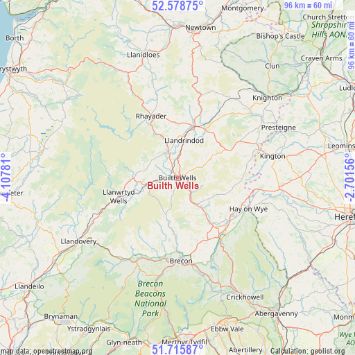
Builth Wells GPS coordinates[2]
52° 8' 57.84" North, 3° 24' 16.884" West
| Map corner | latitude | longitude |
|---|---|---|
| Upper-left | 52.57875°, | -4.10781° |
| Center: | 52.1494°, | -3.40469° |
| Lower-right: | 51.71587°, | -2.70156° |
| Map W x H: | 95.9×95.9 km | = 59.6×59.6mi |
| max Lat: | 60.39635° ⇑57.7% North |
| Builth Wells: | 52.1494° |
| min Lat: | ⇓42.3% South 34.60088° |
| min Long | Builth Wells | max Long |
| -7.64133° | -3.40469° | 32.95536° |
| W 19.1%⇐ | ⇒80.9% E |
Elevation
Elevation of Builth Wells is 130 m = 427 ft, and this is 57.1 m = 187 ft above average elevation for this country.
| Max E: |
515 m = 1690 ft | 15.8% |
| Builth Wells | 130 m 427 ft | |
| Avg. | 72.9 m = 239 ft | |
Min E: |
-30 m = -98 ft | 84.2% |
See also: United Kingdom elevation on elevation.city.
Geographical zone
Builth Wells is located in North temperate zone (between Tropic of Cancer and the Arctic Circle). Distance of this North polar circle is 1602.7 km =995.9 mi to North.| Distance of | km | miles | from Builth Wells |
|---|---|---|---|
| North Pole | 4208.6 | 2615.1 | to North |
| Arctic Circle | 1602.7 | 995.9 | to North |
| Tropic Cancer | 3192.6 | 1983.8 | to South |
| Equator | 5798.5 | 3603 | to South |


Nearby cities:
15 places around Builth Wells: (largest is in red/bold)
• Brecon
22.6 km =14 mi,  177°
177°
• Clifford
21.5 km =13.4 mi,  104°
104°
• Clyro
18.8 km =11.7 mi,  112°
112°
• Dorstone
29.1 km =18.1 mi, 108°
• Eardisley
27.1 km =16.8 mi,  92°
92°
• Hay
20.9 km =13 mi, 114°
• Kington
26.6 km =16.5 mi,  76°
76°
• Llandrindod Wells
10.4 km =6.5 mi,  9°
9°
• Llanwrtyd Wells
16.7 km =10.4 mi,  253°
253°
• Lyonshall
29.8 km =18.5 mi, 79°
• Newbridge on Wye
7.6 km =4.7 mi,  340°
340°
• Penybont
14.9 km =9.3 mi,  28°
28°
• Rhayader
18.4 km =11.4 mi, 336°
• Talgarth
20.8 km =12.9 mi,  145°
145°
• Whitton
28.5 km =17.7 mi,  53°
53°
Sources, notices
• [Note1] Compared only with cities in United Kingdom existing in our database
• [Src1] Map data: © OpenStreetMap contributors (CC-BY-SA)
• [Src2] Other city data from geonames.org with taken over terms of usage.
• [Src3] Geographical zone / Annual Mean Temperature by Robert A. Rohde @ Wikipedia
