Leigh geodata
Leigh (England) is a populated place; located in United Kingdom in Europe/London (GMT+1) time zone. With population of 43,626 people, there are 274 cities with bigger population in this country. Compared to other cities in United Kingdom, 69.7% of cities are located further ↓South; 65.5% of cities are located further →East and 70.9% of cities have higher elevation than Leigh. Note1


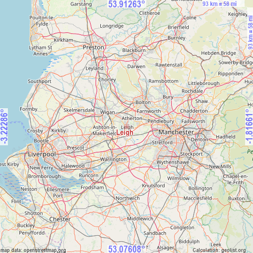
Leigh GPS coordinates[2]
53° 29' 47.112" North, 2° 31' 11.028" West
| Map corner | latitude | longitude |
|---|---|---|
| Upper-left | 53.91263°, | -3.22286° |
| Center: | 53.49642°, | -2.51973° |
| Lower-right: | 53.07608°, | -1.81661° |
| Map W x H: | 93×93 km | = 57.8×57.8mi |
| max Lat: | 60.39635° ⇑30.3% North |
| Leigh: | 53.49642° |
| min Lat: | ⇓69.7% South 34.60088° |
| min Long | Leigh | max Long |
| -7.64133° | -2.51973° | 32.95536° |
| W 34.5%⇐ | ⇒65.5% E |
Elevation
Elevation of Leigh is 32 m = 105 ft, and this is 40.9 m = 134 ft below average elevation for this country.
| Max E: |
515 m = 1690 ft | 70.9% |
| Avg. | 72.9 m = 239 ft | |
| Leigh | 32 m = 105 ft | |
Min E: |
-30 m = -98 ft | 29.1% |
See also: Leigh elevation on elevation.city.
Geographical zone
Leigh is located in North temperate zone (between Tropic of Cancer and the Arctic Circle). Distance of this North polar circle is 1452.9 km =902.8 mi to North.| Distance of | km | miles | from Leigh |
|---|---|---|---|
| North Pole | 4058.8 | 2522 | to North |
| Arctic Circle | 1452.9 | 902.8 | to North |
| Tropic Cancer | 3342.3 | 2076.8 | to South |
| Equator | 5948.2 | 3696 | to South |


Nearby cities:
15 places around Leigh: (largest is in red/bold)
• Abram
5 km =3.1 mi,  285°
285°
• Ashton in Makerfield
8.7 km =5.4 mi,  260°
260°
• Atherton
3.5 km =2.2 mi,  29°
29°
• Bickershaw
3.8 km =2.4 mi,  300°
300°
• Croft
7.3 km =4.5 mi,  195°
195°
• Culcheth
5 km =3.1 mi,  180°
180°
• Glazebury
3.2 km =2 mi,  153°
153°
• Golborne
5.5 km =3.4 mi,  246°
246°
• Hindley
5.9 km =3.7 mi,  314°
314°
• Ince-in-Makerfield
7.6 km =4.7 mi, 302°
• Little Hulton
8 km =5 mi,  58°
58°
• Newton-le-Willows
7.4 km =4.6 mi,  225°
225°
• Tyldesley
4 km =2.5 mi, 60°
• Walkden
8.2 km =5.1 mi,  74°
74°
• Westhoughton
5.9 km =3.7 mi,  356°
356°
Sources, notices
• [Note1] Compared only with cities in United Kingdom existing in our database
• [Src1] Map data: © OpenStreetMap contributors (CC-BY-SA)
• [Src2] Other city data from geonames.org with taken over terms of usage.
• [Src3] Geographical zone / Annual Mean Temperature by Robert A. Rohde @ Wikipedia
