Kingswood geodata
Kingswood (England) is a populated place; located in United Kingdom in Europe/London (GMT+0) time zone. With population of 64,793 people, there are 163 cities with bigger population in this country. Compared to other cities in United Kingdom, 79.3% of cities are located further ↑North; 65.3% of cities are located further →East and 74.2% of cities have lower elevation than Kingswood. Note1


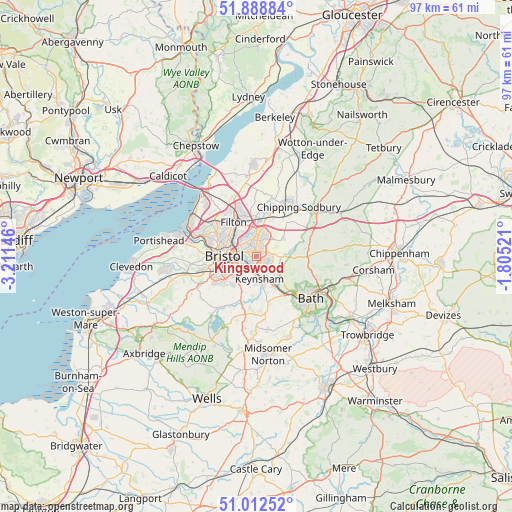
Kingswood GPS coordinates[2]
51° 27' 10.008" North, 2° 30' 29.988" West
| Map corner | latitude | longitude |
|---|---|---|
| Upper-left | 51.88884°, | -3.21146° |
| Center: | 51.45278°, | -2.50833° |
| Lower-right: | 51.01252°, | -1.80521° |
| Map W x H: | 97.4×97.4 km | = 60.5×60.5mi |
| max Lat: | 60.39635° ⇑79.3% North |
| Kingswood: | 51.45278° |
| min Lat: | ⇓20.7% South 34.60088° |
| min Long | Kingswood | max Long |
| -7.64133° | -2.50833° | 32.95536° |
| W 34.7%⇐ | ⇒65.3% E |
Elevation
Elevation of Kingswood is 104 m = 341 ft, and this is 31.1 m = 102 ft above average elevation for this country.
| Max E: |
515 m = 1690 ft | 25.8% |
| Kingswood | 104 m 341 ft | |
| Avg. | 72.9 m = 239 ft | |
Min E: |
-30 m = -98 ft | 74.2% |
See also: Kingswood elevation on elevation.city.
Geographical zone
Kingswood is located in North temperate zone (between Tropic of Cancer and the Arctic Circle). Distance of this North polar circle is 1680.2 km =1044 mi to North.| Distance of | km | miles | from Kingswood |
|---|---|---|---|
| North Pole | 4286 | 2663.2 | to North |
| Arctic Circle | 1680.2 | 1044 | to North |
| Tropic Cancer | 3115.1 | 1935.6 | to South |
| Equator | 5721 | 3554.9 | to South |


Nearby cities:
15 places around Kingswood: (largest is in red/bold)
• Bitton
4.6 km =2.9 mi,  132°
132°
• Bristol
6.1 km =3.8 mi,  272°
272°
• Compton Dando
8.2 km =5.1 mi,  182°
182°
• Corston
8.9 km =5.5 mi,  147°
147°
• Keynsham
4.4 km =2.7 mi,  170°
170°
• Mangotsfield
3.9 km =2.4 mi,  4°
4°
• Publow
8.6 km =5.3 mi,  196°
196°
• Pucklechurch
6.3 km =3.9 mi,  54°
54°
• Saltford
6.6 km =4.1 mi, 149°
• Siston
4.7 km =2.9 mi,  59°
59°
• Stoke Gifford
7.5 km =4.7 mi,  342°
342°
• Westerleigh
8.7 km =5.4 mi,  36°
36°
• Whitchurch
6.4 km =4 mi,  215°
215°
• Wick
5.9 km =3.7 mi,  89°
89°
• Winterbourne
7.8 km =4.8 mi, 2°
Sources, notices
• [Note1] Compared only with cities in United Kingdom existing in our database
• [Src1] Map data: © OpenStreetMap contributors (CC-BY-SA)
• [Src2] Other city data from geonames.org with taken over terms of usage.
• [Src3] Geographical zone / Annual Mean Temperature by Robert A. Rohde @ Wikipedia
