Kidwelly geodata
Kidwelly (Wales) is a seat of a third-order administrative division; located in United Kingdom in Europe/London (GMT+1) time zone. With population of 2,782 people, there are 2211 cities with bigger population in this country. Compared to other cities in United Kingdom, 69.7% of cities are located further ↑North; 91.5% of cities are located further →East and 84.7% of cities have higher elevation than Kidwelly. Note1


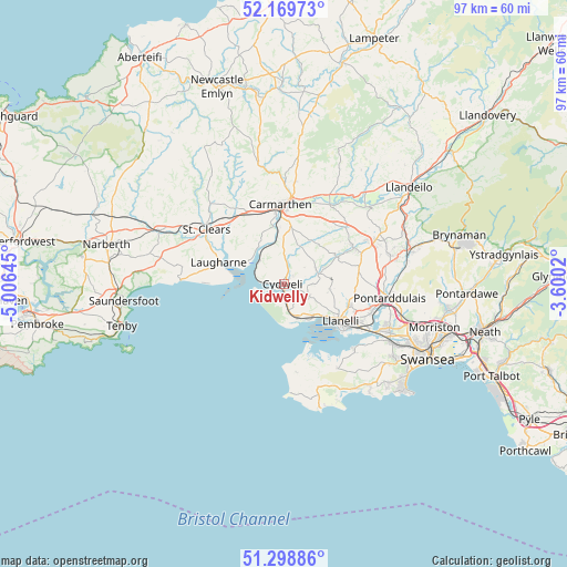
Kidwelly GPS coordinates[2]
51° 44' 11.004" North, 4° 18' 11.988" West
| Map corner | latitude | longitude |
|---|---|---|
| Upper-left | 52.16973°, | -5.00645° |
| Center: | 51.73639°, | -4.30333° |
| Lower-right: | 51.29886°, | -3.6002° |
| Map W x H: | 96.8×96.8 km | = 60.1×60.1mi |
| max Lat: | 60.39635° ⇑69.7% North |
| Kidwelly: | 51.73639° |
| min Lat: | ⇓30.3% South 34.60088° |
| min Long | Kidwelly | max Long |
| -7.64133° | -4.30333° | 32.95536° |
| W 8.5%⇐ | ⇒91.5% E |
Elevation
Elevation of Kidwelly is 16 m = 52 ft, and this is 56.9 m = 187 ft below average elevation for this country.
| Max E: |
515 m = 1690 ft | 84.7% |
| Avg. | 72.9 m = 239 ft | |
| Kidwelly | 16 m = 52 ft | |
Min E: |
-30 m = -98 ft | 15.3% |
See also: United Kingdom elevation on elevation.city.
Geographical zone
Kidwelly is located in North temperate zone (between Tropic of Cancer and the Arctic Circle). Distance of this North polar circle is 1648.6 km =1024.4 mi to North.| Distance of | km | miles | from Kidwelly |
|---|---|---|---|
| North Pole | 4254.5 | 2643.6 | to North |
| Arctic Circle | 1648.6 | 1024.4 | to North |
| Tropic Cancer | 3146.6 | 1955.2 | to South |
| Equator | 5752.5 | 3574.4 | to South |


Nearby cities:
15 places around Kidwelly: (largest is in red/bold)
• Burry Port
7 km =4.3 mi,  146°
146°
• Carmarthen
13.2 km =8.2 mi,  359°
359°
• Carway
5.2 km =3.2 mi,  89°
89°
• Ferryside
5.7 km =3.5 mi,  307°
307°
• Laugharne
11.6 km =7.2 mi,  289°
289°
• Llanddarog
13.4 km =8.3 mi,  41°
41°
• Llanelli
11.5 km =7.1 mi,  121°
121°
• Llangain
9.6 km =6 mi,  341°
341°
• Llangynog
11.9 km =7.4 mi,  322°
322°
• Llannon
13 km =8.1 mi,  80°
80°
• Llansteffan
7.3 km =4.5 mi,  303°
303°
• Pont Henri
7.1 km =4.4 mi,  67°
67°
• Pontyates
6.2 km =3.9 mi, 73°
• Pontyberem
10.4 km =6.5 mi,  63°
63°
• Trimsaran
4.6 km =2.9 mi,  113°
113°
Sources, notices
• [Note1] Compared only with cities in United Kingdom existing in our database
• [Src1] Map data: © OpenStreetMap contributors (CC-BY-SA)
• [Src2] Other city data from geonames.org with taken over terms of usage.
• [Src3] Geographical zone / Annual Mean Temperature by Robert A. Rohde @ Wikipedia
