Islington geodata
Islington (England) is a seat of a third-order administrative division; located in United Kingdom in Europe/London (GMT+1) time zone. With population of 319,143 people, there are 17 cities with bigger population in this country. Compared to other cities in United Kingdom, 76.6% of cities are located further ↑North; 84.9% of cities are located further ←West and 66.8% of cities have higher elevation than Islington. Note1


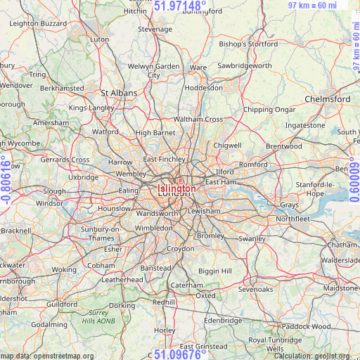
Islington GPS coordinates[2]
51° 32' 10.392" North, 0° 6' 10.944" West
| Map corner | latitude | longitude |
|---|---|---|
| Upper-left | 51.97148°, | -0.80616° |
| Center: | 51.53622°, | -0.10304° |
| Lower-right: | 51.09676°, | 0.60009° |
| Map W x H: | 97.3×97.3 km | = 60.5×60.5mi |
| max Lat: | 60.39635° ⇑76.6% North |
| Islington: | 51.53622° |
| min Lat: | ⇓23.4% South 34.60088° |
| min Long | Islington | max Long |
| -7.64133° | -0.10304° | 32.95536° |
| W 84.9%⇐ | ⇒15.1% E |
Elevation
Elevation of Islington is 37 m = 121 ft, and this is 35.9 m = 118 ft below average elevation for this country.
| Max E: |
515 m = 1690 ft | 66.8% |
| Avg. | 72.9 m = 239 ft | |
| Islington | 37 m = 121 ft | |
Min E: |
-30 m = -98 ft | 33.2% |
See also: Islington elevation on elevation.city.
Geographical zone
Islington is located in North temperate zone (between Tropic of Cancer and the Arctic Circle). Distance of this North polar circle is 1670.9 km =1038.2 mi to North.| Distance of | km | miles | from Islington |
|---|---|---|---|
| North Pole | 4276.8 | 2657.5 | to North |
| Arctic Circle | 1670.9 | 1038.2 | to North |
| Tropic Cancer | 3124.4 | 1941.4 | to South |
| Equator | 5730.3 | 3560.6 | to South |


Nearby cities:
15 places around Islington: (largest is in red/bold)
• Archway
4.1 km =2.5 mi,  328°
328°
• Barbican
1.9 km =1.2 mi,  161°
161°
• Barnsbury
1.1 km =0.7 mi,  297°
297°
• Belsize Park
5 km =3.1 mi,  284°
284°
• Bethnal Green
3.1 km =1.9 mi,  109°
109°
• Camden Town
2.8 km =1.7 mi, 279°
• City of London
2.7 km =1.7 mi, 163°
• City of Westminster
4.9 km =3 mi,  207°
207°
• Clerkenwell
1.4 km =0.9 mi,  200°
200°
• Crouch End
5 km =3.1 mi,  343°
343°
• Hackney
4 km =2.5 mi,  67°
67°
• Holloway
2.4 km =1.5 mi,  319°
319°
• Lambeth
4.5 km =2.8 mi,  187°
187°
• London
3.5 km =2.2 mi, 207°
• West End of London
4.4 km =2.7 mi,  235°
235°
In other languages:
- In France: District londonien d'Islington
- In Russian: Ислингтон
- In Chinese: 伊斯靈頓
Sources, notices
• [Note1] Compared only with cities in United Kingdom existing in our database
• [Src1] Map data: © OpenStreetMap contributors (CC-BY-SA)
• [Src2] Other city data from geonames.org with taken over terms of usage.
• [Src3] Geographical zone / Annual Mean Temperature by Robert A. Rohde @ Wikipedia
