Hunstanton geodata
Hunstanton (England) is a populated place; located in United Kingdom in Europe/London (GMT+1) time zone. With population of 9,332 people, there are 1111 cities with bigger population in this country. Compared to other cities in United Kingdom, 59.8% of cities are located further ↓South; 92.3% of cities are located further ←West and 77.1% of cities have higher elevation than Hunstanton. Note1
Administrative division(s):
- Level 1: England
- Level 2: Norfolk
- Level 3: King's Lynn and West Norfolk District
- Level 4: Old Hunstanton


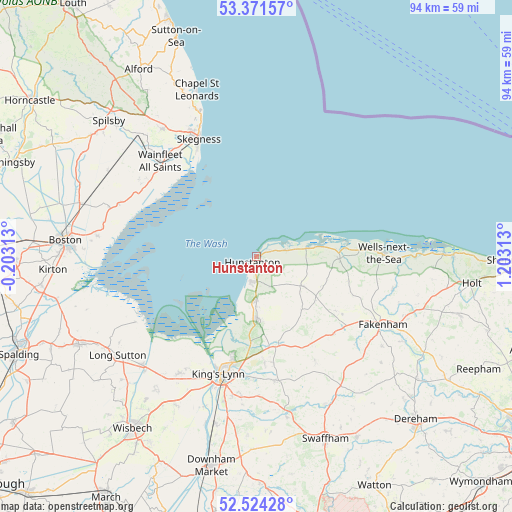
Hunstanton GPS coordinates[2]
52° 57' 0" North, 0° 30' 0" East
| Map corner | latitude | longitude |
|---|---|---|
| Upper-left | 53.37157°, | -0.20313° |
| Center: | 52.95°, | 0.5° |
| Lower-right: | 52.52428°, | 1.20313° |
| Map W x H: | 94.2×94.2 km | = 58.5×58.5mi |
| max Lat: | 60.39635° ⇑40.2% North |
| Hunstanton: | 52.95° |
| min Lat: | ⇓59.8% South 34.60088° |
| min Long | Hunstanton | max Long |
| -7.64133° | 0.5° | 32.95536° |
| W 92.3%⇐ | ⇒7.7% E |
Elevation
Elevation of Hunstanton is 24 m = 79 ft, and this is 48.9 m = 160 ft below average elevation for this country.
| Max E: |
515 m = 1690 ft | 77.1% |
| Avg. | 72.9 m = 239 ft | |
| Hunstanton | 24 m = 79 ft | |
Min E: |
-30 m = -98 ft | 22.9% |
See also: United Kingdom elevation on elevation.city.
Geographical zone
Hunstanton is located in North temperate zone (between Tropic of Cancer and the Arctic Circle). Distance of this North polar circle is 1513.7 km =940.6 mi to North.| Distance of | km | miles | from Hunstanton |
|---|---|---|---|
| North Pole | 4119.6 | 2559.8 | to North |
| Arctic Circle | 1513.7 | 940.6 | to North |
| Tropic Cancer | 3281.6 | 2039.1 | to South |
| Equator | 5887.5 | 3658.3 | to South |


Nearby cities:
15 places around Hunstanton: (largest is in red/bold)
• Burnham Market
15.2 km =9.4 mi,  91°
91°
• Clenchwarton
23.6 km =14.7 mi,  203°
203°
• Dersingham
11.6 km =7.2 mi,  178°
178°
• Docking
10 km =6.2 mi,  122°
122°
• East Rudham
20.2 km =12.6 mi,  135°
135°
• Great Massingham
22.3 km =13.9 mi,  150°
150°
• Grimston
19.9 km =12.4 mi,  170°
170°
• Heacham
4.7 km =2.9 mi,  185°
185°
• King's Lynn
23.1 km =14.4 mi, 197°
• Sedgeford
6.4 km =4 mi, 151°
• Skegness
24.1 km =15 mi,  333°
333°
• Snettisham
7.9 km =4.9 mi, 179°
• South Creake
19.2 km =11.9 mi,  112°
112°
• Wainfleet All Saints
24.7 km =15.3 mi,  314°
314°
• Wells-next-the-Sea
23.5 km =14.6 mi, 89°
Sources, notices
• [Note1] Compared only with cities in United Kingdom existing in our database
• [Src1] Map data: © OpenStreetMap contributors (CC-BY-SA)
• [Src2] Other city data from geonames.org with taken over terms of usage.
• [Src3] Geographical zone / Annual Mean Temperature by Robert A. Rohde @ Wikipedia
