Highclere geodata
Highclere (England) is a populated place; located in United Kingdom in Europe/London (GMT+1) time zone. With population of 2,463 people, there are 2360 cities with bigger population in this country. Compared to other cities in United Kingdom, 83% of cities are located further ↑North; 58.2% of cities are located further ←West and 85.9% of cities have lower elevation than Highclere. Note1
Administrative division(s):
- Level 1: England
- Level 2: Hampshire
- Level 3: Basingstoke and Deane District
- Level 4: Highclere


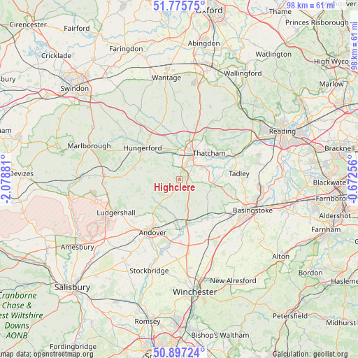
Highclere GPS coordinates[2]
51° 20' 18.96" North, 1° 22' 32.484" West
| Map corner | latitude | longitude |
|---|---|---|
| Upper-left | 51.77575°, | -2.07881° |
| Center: | 51.3386°, | -1.37569° |
| Lower-right: | 50.89724°, | -0.67256° |
| Map W x H: | 97.7×97.7 km | = 60.7×60.7mi |
| max Lat: | 60.39635° ⇑83% North |
| Highclere: | 51.3386° |
| min Lat: | ⇓17% South 34.60088° |
| min Long | Highclere | max Long |
| -7.64133° | -1.37569° | 32.95536° |
| W 58.2%⇐ | ⇒41.8% E |
Elevation
Elevation of Highclere is 135 m = 443 ft, and this is 62.1 m = 204 ft above average elevation for this country.
| Max E: |
515 m = 1690 ft | 14.1% |
| Highclere | 135 m 443 ft | |
| Avg. | 72.9 m = 239 ft | |
Min E: |
-30 m = -98 ft | 85.9% |
See also: United Kingdom elevation on elevation.city.
Geographical zone
Highclere is located in North temperate zone (between Tropic of Cancer and the Arctic Circle). Distance of this North polar circle is 1692.9 km =1051.9 mi to North.| Distance of | km | miles | from Highclere |
|---|---|---|---|
| North Pole | 4298.7 | 2671.1 | to North |
| Arctic Circle | 1692.9 | 1051.9 | to North |
| Tropic Cancer | 3102.4 | 1927.7 | to South |
| Equator | 5708.3 | 3547 | to South |


Nearby cities:
15 places around Highclere: (largest is in red/bold)
• Burghclere
3.8 km =2.4 mi,  72°
72°
• Cold Ash
12.3 km =7.6 mi,  38°
38°
• Greenham
7 km =4.3 mi, 39°
• Hungerford
12.9 km =8 mi,  311°
311°
• Hurstbourne Tarrant
8.8 km =5.5 mi,  217°
217°
• Kingsclere
9.3 km =5.8 mi,  99°
99°
• Kintbury
8.5 km =5.3 mi,  323°
323°
• Newbury
7.8 km =4.8 mi,  26°
26°
• Overton
13.2 km =8.2 mi,  142°
142°
• Shalbourne
12.5 km =7.8 mi,  282°
282°
• St Mary Bourne
9.6 km =6 mi,  191°
191°
• Thatcham
10.8 km =6.7 mi,  47°
47°
• Vernham Dean
10.1 km =6.3 mi,  249°
249°
• Wickham
12.3 km =7.6 mi,  341°
341°
• Winterbourne
12.1 km =7.5 mi,  9°
9°
Sources, notices
• [Note1] Compared only with cities in United Kingdom existing in our database
• [Src1] Map data: © OpenStreetMap contributors (CC-BY-SA)
• [Src2] Other city data from geonames.org with taken over terms of usage.
• [Src3] Geographical zone / Annual Mean Temperature by Robert A. Rohde @ Wikipedia
