Hetton geodata
Hetton (England) is a seat of a fourth-order administrative division; located in United Kingdom in Europe/London (GMT+1) time zone. In our database, there are 4977 cities with bigger population. Compared to other cities in United Kingdom, 78.8% of cities are located further ↓South; 55.9% of cities are located further →East and 95.9% of cities have lower elevation than Hetton. Note1
Administrative division(s):
- Level 1: England
- Level 2: North Yorkshire
- Level 3: Craven District
- Level 4: Hetton


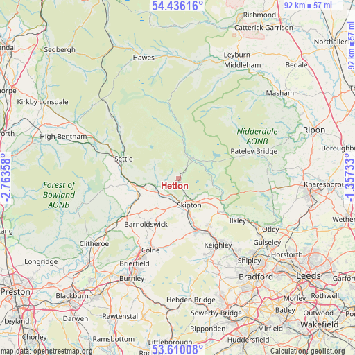
Hetton GPS coordinates[2]
54° 1' 30.612" North, 2° 3' 37.62" West
| Map corner | latitude | longitude |
|---|---|---|
| Upper-left | 54.43616°, | -2.76358° |
| Center: | 54.02517°, | -2.06045° |
| Lower-right: | 53.61008°, | -1.35733° |
| Map W x H: | 91.9×91.8 km | = 57.1×57mi |
| max Lat: | 60.39635° ⇑21.2% North |
| Hetton: | 54.02517° |
| min Lat: | ⇓78.8% South 34.60088° |
| min Long | Hetton | max Long |
| -7.64133° | -2.06045° | 32.95536° |
| W 44.1%⇐ | ⇒55.9% E |
Elevation
Elevation of Hetton is 193 m = 633 ft, and this is 120.1 m = 394 ft above average elevation for this country.
| Max E: |
515 m = 1690 ft | 4.1% |
| Hetton | 193 m 633 ft | |
| Avg. | 72.9 m = 239 ft | |
Min E: |
-30 m = -98 ft | 95.9% |
See also: United Kingdom elevation on elevation.city.
Geographical zone
Hetton is located in North temperate zone (between Tropic of Cancer and the Arctic Circle). Distance of this North polar circle is 1394.1 km =866.3 mi to North.| Distance of | km | miles | from Hetton |
|---|---|---|---|
| North Pole | 4000 | 2485.5 | to North |
| Arctic Circle | 1394.1 | 866.3 | to North |
| Tropic Cancer | 3401.1 | 2113.3 | to South |
| Equator | 6007 | 3732.6 | to South |


Nearby cities:
15 places around Hetton: (largest is in red/bold)
• Addingham
14.6 km =9.1 mi,  127°
127°
• Barnoldswick
14.6 km =9.1 mi,  214°
214°
• Cononley
12.3 km =7.6 mi,  166°
166°
• Cross Hills
14.1 km =8.8 mi,  159°
159°
• Earby
13.3 km =8.3 mi,  203°
203°
• Embsay
7 km =4.3 mi,  140°
140°
• Gargrave
5.5 km =3.4 mi, 211°
• Glusburn
14.5 km =9 mi, 164°
• Grassington
6.6 km =4.1 mi,  38°
38°
• Hellifield
10.9 km =6.8 mi,  257°
257°
• Long Preston
12.8 km =8 mi,  267°
267°
• Low Bradley
11.2 km =7 mi, 157°
• Otterburn
7.8 km =4.8 mi, 262°
• Skipton
7.6 km =4.7 mi, 158°
• Winterburn
2.7 km =1.7 mi, 265°
Sources, notices
• [Note1] Compared only with cities in United Kingdom existing in our database
• [Src1] Map data: © OpenStreetMap contributors (CC-BY-SA)
• [Src2] Other city data from geonames.org with taken over terms of usage.
• [Src3] Geographical zone / Annual Mean Temperature by Robert A. Rohde @ Wikipedia
