Grassington geodata
Grassington (England) is a populated place; located in United Kingdom in Europe/London (GMT+1) time zone. With population of 1,792 people, there are 2785 cities with bigger population in this country. Compared to other cities in United Kingdom, 79.1% of cities are located further ↓South; 54.7% of cities are located further →East and 96.7% of cities have lower elevation than Grassington. Note1
Administrative division(s):
- Level 1: England
- Level 2: North Yorkshire
- Level 3: Craven District
- Level 4: Grassington


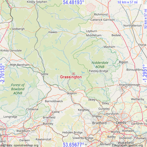
Grassington GPS coordinates[2]
54° 4' 17.04" North, 1° 59' 53.592" West
| Map corner | latitude | longitude |
|---|---|---|
| Upper-left | 54.48193°, | -2.70135° |
| Center: | 54.0714°, | -1.99822° |
| Lower-right: | 53.65677°, | -1.2951° |
| Map W x H: | 91.7×91.7 km | = 57×57mi |
| max Lat: | 60.39635° ⇑20.9% North |
| Grassington: | 54.0714° |
| min Lat: | ⇓79.1% South 34.60088° |
| min Long | Grassington | max Long |
| -7.64133° | -1.99822° | 32.95536° |
| W 45.3%⇐ | ⇒54.7% E |
Elevation
Elevation of Grassington is 202 m = 663 ft, and this is 129.1 m = 424 ft above average elevation for this country.
| Max E: |
515 m = 1690 ft | 3.3% |
| Grassington | 202 m 663 ft | |
| Avg. | 72.9 m = 239 ft | |
Min E: |
-30 m = -98 ft | 96.7% |
See also: United Kingdom elevation on elevation.city.
Geographical zone
Grassington is located in North temperate zone (between Tropic of Cancer and the Arctic Circle). Distance of this North polar circle is 1389 km =863.1 mi to North.| Distance of | km | miles | from Grassington |
|---|---|---|---|
| North Pole | 3994.9 | 2482.3 | to North |
| Arctic Circle | 1389 | 863.1 | to North |
| Tropic Cancer | 3406.3 | 2116.6 | to South |
| Equator | 6012.2 | 3735.8 | to South |


Nearby cities:
15 places around Grassington: (largest is in red/bold)
• Addingham
16 km =9.9 mi,  152°
152°
• Cononley
17.1 km =10.6 mi,  184°
184°
• Cross Hills
18.4 km =11.4 mi, 177°
• Embsay
10.5 km =6.5 mi, 178°
• Gargrave
12 km =7.5 mi,  215°
215°
• Hellifield
16.4 km =10.2 mi,  243°
243°
• Hetton
6.6 km =4.1 mi, 218°
• Long Preston
17.8 km =11.1 mi,  251°
251°
• Low Bradley
15.5 km =9.6 mi, 179°
• Otterburn
13.3 km =8.3 mi, 242°
• Pateley Bridge
15.6 km =9.7 mi,  83°
83°
• Settle
18.2 km =11.3 mi,  269°
269°
• Silsden
17.9 km =11.1 mi,  167°
167°
• Skipton
12.3 km =7.6 mi,  185°
185°
• Winterburn
8.6 km =5.3 mi,  231°
231°
Sources, notices
• [Note1] Compared only with cities in United Kingdom existing in our database
• [Src1] Map data: © OpenStreetMap contributors (CC-BY-SA)
• [Src2] Other city data from geonames.org with taken over terms of usage.
• [Src3] Geographical zone / Annual Mean Temperature by Robert A. Rohde @ Wikipedia
