Grays geodata
Grays (England) is a seat of a second-order administrative division; located in United Kingdom in Europe/London (GMT+1) time zone. With population of 89,755 people, there are 112 cities with bigger population in this country. Compared to other cities in United Kingdom, 78.5% of cities are located further ↑North; 90.6% of cities are located further ←West and 88.2% of cities have higher elevation than Grays. Note1


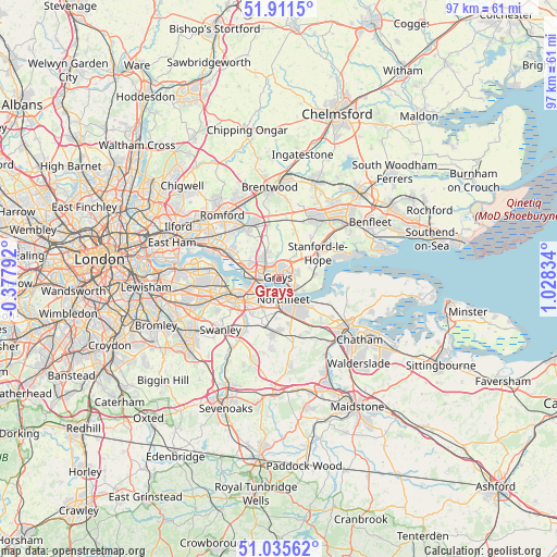
Grays GPS coordinates[2]
51° 28' 32.376" North, 0° 19' 30.756" East
| Map corner | latitude | longitude |
|---|---|---|
| Upper-left | 51.9115°, | -0.37792° |
| Center: | 51.47566°, | 0.32521° |
| Lower-right: | 51.03562°, | 1.02834° |
| Map W x H: | 97.4×97.4 km | = 60.5×60.5mi |
| max Lat: | 60.39635° ⇑78.5% North |
| Grays: | 51.47566° |
| min Lat: | ⇓21.5% South 34.60088° |
| min Long | Grays | max Long |
| -7.64133° | 0.32521° | 32.95536° |
| W 90.6%⇐ | ⇒9.4% E |
Elevation
Elevation of Grays is 13 m = 43 ft, and this is 59.9 m = 197 ft below average elevation for this country.
| Max E: |
515 m = 1690 ft | 88.2% |
| Avg. | 72.9 m = 239 ft | |
| Grays | 13 m = 43 ft | |
Min E: |
-30 m = -98 ft | 11.8% |
See also: Grays elevation on elevation.city.
Geographical zone
Grays is located in North temperate zone (between Tropic of Cancer and the Arctic Circle). Distance of this North polar circle is 1677.6 km =1042.4 mi to North.| Distance of | km | miles | from Grays |
|---|---|---|---|
| North Pole | 4283.5 | 2661.6 | to North |
| Arctic Circle | 1677.6 | 1042.4 | to North |
| Tropic Cancer | 3117.6 | 1937.2 | to South |
| Equator | 5723.6 | 3556.5 | to South |


Nearby cities:
15 places around Grays: (largest is in red/bold)
• Aveley
5.8 km =3.6 mi,  297°
297°
• Chadwell St Mary
2.7 km =1.7 mi,  76°
76°
• Chafford Hundred
2.6 km =1.6 mi,  305°
305°
• Darenth
7.6 km =4.7 mi,  217°
217°
• East Tilbury
6.4 km =4 mi,  85°
85°
• Gravesend
4.9 km =3 mi,  139°
139°
• Greenhithe
3.9 km =2.4 mi, 224°
• Orsett
5 km =3.1 mi,  35°
35°
• Purfleet
5.8 km =3.6 mi,  279°
279°
• South Ockendon
4.6 km =2.9 mi,  321°
321°
• Southfleet
6.6 km =4.1 mi,  182°
182°
• Stone
5.1 km =3.2 mi,  236°
236°
• Swanscombe
3.3 km =2.1 mi,  198°
198°
• Tilbury
2.7 km =1.7 mi,  122°
122°
• West Thurrock
3.4 km =2.1 mi,  274°
274°
Sources, notices
• [Note1] Compared only with cities in United Kingdom existing in our database
• [Src1] Map data: © OpenStreetMap contributors (CC-BY-SA)
• [Src2] Other city data from geonames.org with taken over terms of usage.
• [Src3] Geographical zone / Annual Mean Temperature by Robert A. Rohde @ Wikipedia
