Frosterley geodata
Frosterley (England) is a populated place; located in United Kingdom in Europe/London (GMT+1) time zone. With population of 636 people, there are 4475 cities with bigger population in this country. Compared to other cities in United Kingdom, 84.4% of cities are located further ↓South; 53.9% of cities are located further →East and 94.1% of cities have lower elevation than Frosterley. Note1


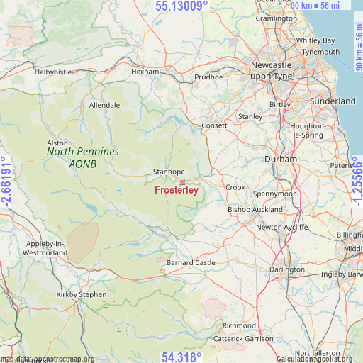
Frosterley GPS coordinates[2]
54° 43' 33.888" North, 1° 57' 31.644" West
| Map corner | latitude | longitude |
|---|---|---|
| Upper-left | 55.13009°, | -2.66191° |
| Center: | 54.72608°, | -1.95879° |
| Lower-right: | 54.318°, | -1.25566° |
| Map W x H: | 90.3×90.3 km | = 56.1×56.1mi |
| max Lat: | 60.39635° ⇑15.6% North |
| Frosterley: | 54.72608° |
| min Lat: | ⇓84.4% South 34.60088° |
| min Long | Frosterley | max Long |
| -7.64133° | -1.95879° | 32.95536° |
| W 46.1%⇐ | ⇒53.9% E |
Elevation
Elevation of Frosterley is 175 m = 574 ft, and this is 102.1 m = 335 ft above average elevation for this country.
| Max E: |
515 m = 1690 ft | 5.9% |
| Frosterley | 175 m 574 ft | |
| Avg. | 72.9 m = 239 ft | |
Min E: |
-30 m = -98 ft | 94.1% |
See also: United Kingdom elevation on elevation.city.
Geographical zone
Frosterley is located in North temperate zone (between Tropic of Cancer and the Arctic Circle). Distance of this North polar circle is 1316.2 km =817.8 mi to North.| Distance of | km | miles | from Frosterley |
|---|---|---|---|
| North Pole | 3922.1 | 2437.1 | to North |
| Arctic Circle | 1316.2 | 817.8 | to North |
| Tropic Cancer | 3479.1 | 2161.8 | to South |
| Equator | 6085 | 3781 | to South |


Nearby cities:
15 places around Frosterley: (largest is in red/bold)
• Castleside
13.1 km =8.1 mi,  23°
23°
• Cockfield
15.8 km =9.8 mi,  142°
142°
• Crook
13.5 km =8.4 mi,  96°
96°
• Eggleston
13.3 km =8.3 mi,  192°
192°
• Hamsterley
10.3 km =6.4 mi,  117°
117°
• Holwick
15.6 km =9.7 mi,  229°
229°
• Mickleton
14.4 km =8.9 mi,  204°
204°
• Middleton in Teesdale
13.8 km =8.6 mi,  215°
215°
• Muggleswick
12 km =7.5 mi,  7°
7°
• Newbiggin
14.7 km =9.1 mi, 230°
• Romaldkirk
15 km =9.3 mi, 192°
• Stanhope
4.6 km =2.9 mi,  305°
305°
• Tow Law
9.5 km =5.9 mi,  77°
77°
• Witton le Wear
13.1 km =8.1 mi, 115°
• Wolsingham
4.9 km =3 mi, 83°
Sources, notices
• [Note1] Compared only with cities in United Kingdom existing in our database
• [Src1] Map data: © OpenStreetMap contributors (CC-BY-SA)
• [Src2] Other city data from geonames.org with taken over terms of usage.
• [Src3] Geographical zone / Annual Mean Temperature by Robert A. Rohde @ Wikipedia
