Ditton Priors geodata
Ditton Priors (England) is a populated place; located in United Kingdom in Europe/London (GMT+1) time zone. With population of 821 people, there are 3992 cities with bigger population in this country. Compared to other cities in United Kingdom, 50.2% of cities are located further ↓South; 66.5% of cities are located further →East and 98.2% of cities have lower elevation than Ditton Priors. Note1


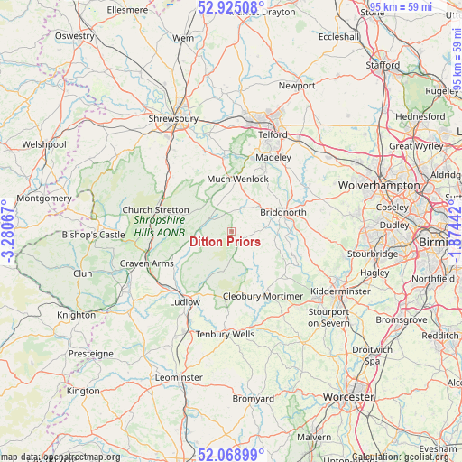
Ditton Priors GPS coordinates[2]
52° 29' 56.832" North, 2° 34' 39.144" West
| Map corner | latitude | longitude |
|---|---|---|
| Upper-left | 52.92508°, | -3.28067° |
| Center: | 52.49912°, | -2.57754° |
| Lower-right: | 52.06899°, | -1.87442° |
| Map W x H: | 95.2×95.2 km | = 59.2×59.2mi |
| max Lat: | 60.39635° ⇑49.8% North |
| Ditton Priors: | 52.49912° |
| min Lat: | ⇓50.2% South 34.60088° |
| min Long | Ditton Priors | max Long |
| -7.64133° | -2.57754° | 32.95536° |
| W 33.5%⇐ | ⇒66.5% E |
Elevation
Elevation of Ditton Priors is 229 m = 751 ft, and this is 156.1 m = 512 ft above average elevation for this country.
| Max E: |
515 m = 1690 ft | 1.8% |
| Ditton Priors | 229 m 751 ft | |
| Avg. | 72.9 m = 239 ft | |
Min E: |
-30 m = -98 ft | 98.2% |
See also: United Kingdom elevation on elevation.city.
Geographical zone
Ditton Priors is located in North temperate zone (between Tropic of Cancer and the Arctic Circle). Distance of this North polar circle is 1563.8 km =971.7 mi to North.| Distance of | km | miles | from Ditton Priors |
|---|---|---|---|
| North Pole | 4169.7 | 2590.9 | to North |
| Arctic Circle | 1563.8 | 971.7 | to North |
| Tropic Cancer | 3231.4 | 2007.9 | to South |
| Equator | 5837.4 | 3627.2 | to South |


Nearby cities:
15 places around Ditton Priors: (largest is in red/bold)
• Acton Burnell
15 km =9.3 mi,  328°
328°
• Alveley
15.8 km =9.8 mi,  107°
107°
• Bridgnorth
11.4 km =7.1 mi,  68°
68°
• Broseley
14.2 km =8.8 mi,  26°
26°
• Cardington
12 km =7.5 mi,  298°
298°
• Church Stretton
15.8 km =9.8 mi,  285°
285°
• Cleobury Mortimer
14.9 km =9.3 mi,  154°
154°
• Cressage
15.1 km =9.4 mi,  352°
352°
• Eardington
11.3 km =7 mi,  81°
81°
• Hampton
13.6 km =8.5 mi, 105°
• Harley
11.3 km =7 mi, 352°
• Highley
14.4 km =8.9 mi, 113°
• Ironbridge
15.6 km =9.7 mi,  23°
23°
• Kenley
11.8 km =7.3 mi,  341°
341°
• Much Wenlock
10.8 km =6.7 mi,  7°
7°
Sources, notices
• [Note1] Compared only with cities in United Kingdom existing in our database
• [Src1] Map data: © OpenStreetMap contributors (CC-BY-SA)
• [Src2] Other city data from geonames.org with taken over terms of usage.
• [Src3] Geographical zone / Annual Mean Temperature by Robert A. Rohde @ Wikipedia
