Church Stretton geodata
Church Stretton (England) is a populated place; located in United Kingdom in Europe/London (GMT+1) time zone. With population of 3,698 people, there are 1926 cities with bigger population in this country. Compared to other cities in United Kingdom, 51% of cities are located further ↓South; 71.1% of cities are located further →East and 95.5% of cities have lower elevation than Church Stretton. Note1


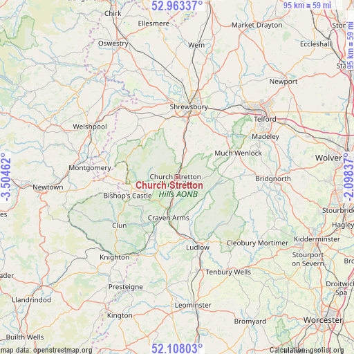
Church Stretton GPS coordinates[2]
52° 32' 16.008" North, 2° 48' 5.364" West
| Map corner | latitude | longitude |
|---|---|---|
| Upper-left | 52.96337°, | -3.50462° |
| Center: | 52.53778°, | -2.80149° |
| Lower-right: | 52.10803°, | -2.09837° |
| Map W x H: | 95.1×95.1 km | = 59.1×59.1mi |
| max Lat: | 60.39635° ⇑49% North |
| Church Stretton: | 52.53778° |
| min Lat: | ⇓51% South 34.60088° |
| min Long | Church Stretton | max Long |
| -7.64133° | -2.80149° | 32.95536° |
| W 28.9%⇐ | ⇒71.1% E |
Elevation
Elevation of Church Stretton is 189 m = 620 ft, and this is 116.1 m = 381 ft above average elevation for this country.
| Max E: |
515 m = 1690 ft | 4.5% |
| Church Stretton | 189 m 620 ft | |
| Avg. | 72.9 m = 239 ft | |
Min E: |
-30 m = -98 ft | 95.5% |
See also: United Kingdom elevation on elevation.city.
Geographical zone
Church Stretton is located in North temperate zone (between Tropic of Cancer and the Arctic Circle). Distance of this North polar circle is 1559.5 km =969 mi to North.| Distance of | km | miles | from Church Stretton |
|---|---|---|---|
| North Pole | 4165.4 | 2588.3 | to North |
| Arctic Circle | 1559.5 | 969 | to North |
| Tropic Cancer | 3235.7 | 2010.6 | to South |
| Equator | 5841.7 | 3629.9 | to South |


Nearby cities:
15 places around Church Stretton: (largest is in red/bold)
• Acton Burnell
11.1 km =6.9 mi,  40°
40°
• Bayston Hill
15.5 km =9.6 mi,  9°
9°
• Berrington
14.2 km =8.8 mi,  28°
28°
• Bishop's Castle
14.5 km =9 mi,  249°
249°
• Cardington
4.8 km =3 mi,  73°
73°
• Condover
12.8 km =8 mi,  15°
15°
• Craven Arms
10.8 km =6.7 mi,  192°
192°
• Dorrington
9.6 km =6 mi, 11°
• Harley
15.3 km =9.5 mi,  63°
63°
• Kenley
13.3 km =8.3 mi, 58°
• Longnor
7.7 km =4.8 mi, 26°
• Lydham
12.3 km =7.6 mi,  258°
258°
• Minsterley
14.2 km =8.8 mi,  323°
323°
• Norbury
10.1 km =6.3 mi,  267°
267°
• Pontesbury
13.7 km =8.5 mi,  333°
333°
Sources, notices
• [Note1] Compared only with cities in United Kingdom existing in our database
• [Src1] Map data: © OpenStreetMap contributors (CC-BY-SA)
• [Src2] Other city data from geonames.org with taken over terms of usage.
• [Src3] Geographical zone / Annual Mean Temperature by Robert A. Rohde @ Wikipedia
