Cowfold geodata
Cowfold (England) is a populated place; located in United Kingdom in Europe/London (GMT+1) time zone. With population of 1,301 people, there are 3251 cities with bigger population in this country. Compared to other cities in United Kingdom, 91.5% of cities are located further ↑North; 81.7% of cities are located further ←West and 73.1% of cities have higher elevation than Cowfold. Note1
Administrative division(s):
- Level 1: England
- Level 2: West Sussex
- Level 3: Horsham District
- Level 4: Cowfold


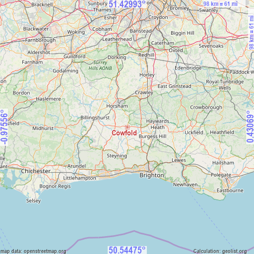
Cowfold GPS coordinates[2]
50° 59' 22.02" North, 0° 16' 20.748" West
| Map corner | latitude | longitude |
|---|---|---|
| Upper-left | 51.42993°, | -0.97556° |
| Center: | 50.98945°, | -0.27243° |
| Lower-right: | 50.54475°, | 0.43069° |
| Map W x H: | 98.4×98.4 km | = 61.1×61.1mi |
| max Lat: | 60.39635° ⇑91.5% North |
| Cowfold: | 50.98945° |
| min Lat: | ⇓8.5% South 34.60088° |
| min Long | Cowfold | max Long |
| -7.64133° | -0.27243° | 32.95536° |
| W 81.7%⇐ | ⇒18.3% E |
Elevation
Elevation of Cowfold is 29 m = 95 ft, and this is 43.9 m = 144 ft below average elevation for this country.
| Max E: |
515 m = 1690 ft | 73.1% |
| Avg. | 72.9 m = 239 ft | |
| Cowfold | 29 m = 95 ft | |
Min E: |
-30 m = -98 ft | 26.9% |
See also: United Kingdom elevation on elevation.city.
Geographical zone
Cowfold is located in North temperate zone (between Tropic of Cancer and the Arctic Circle). Distance of this North polar circle is 1731.7 km =1076 mi to North.| Distance of | km | miles | from Cowfold |
|---|---|---|---|
| North Pole | 4337.6 | 2695.3 | to North |
| Arctic Circle | 1731.7 | 1076 | to North |
| Tropic Cancer | 3063.6 | 1903.6 | to South |
| Equator | 5669.5 | 3522.9 | to South |


Nearby cities:
15 places around Cowfold: (largest is in red/bold)
• Ashington
10.4 km =6.5 mi,  232°
232°
• Ashurst
7.3 km =4.5 mi,  209°
209°
• Barns Green
9.9 km =6.2 mi,  299°
299°
• Bolney
4.9 km =3 mi,  82°
82°
• Burgess Hill
10.4 km =6.5 mi,  109°
109°
• Cuckfield
9.5 km =5.9 mi, 75°
• Handcross
8.7 km =5.4 mi,  35°
35°
• Hassocks
10.1 km =6.3 mi,  132°
132°
• Henfield
6.6 km =4.1 mi,  178°
178°
• Horsham
9.1 km =5.7 mi,  334°
334°
• Hurstpierpoint
8.9 km =5.5 mi, 133°
• Partridge Green
4.2 km =2.6 mi,  216°
216°
• Small Dole
10 km =6.2 mi, 182°
• South Nutfield
10.2 km =6.3 mi,  72°
72°
• Southwater
6.7 km =4.2 mi, 304°
Sources, notices
• [Note1] Compared only with cities in United Kingdom existing in our database
• [Src1] Map data: © OpenStreetMap contributors (CC-BY-SA)
• [Src2] Other city data from geonames.org with taken over terms of usage.
• [Src3] Geographical zone / Annual Mean Temperature by Robert A. Rohde @ Wikipedia
