Cheshunt geodata
Cheshunt (England) is a populated place; located in United Kingdom in Europe/London (GMT+0) time zone. With population of 57,374 people, there are 198 cities with bigger population in this country. Compared to other cities in United Kingdom, 70.9% of cities are located further ↑North; 85.9% of cities are located further ←West and 77.1% of cities have higher elevation than Cheshunt. Note1


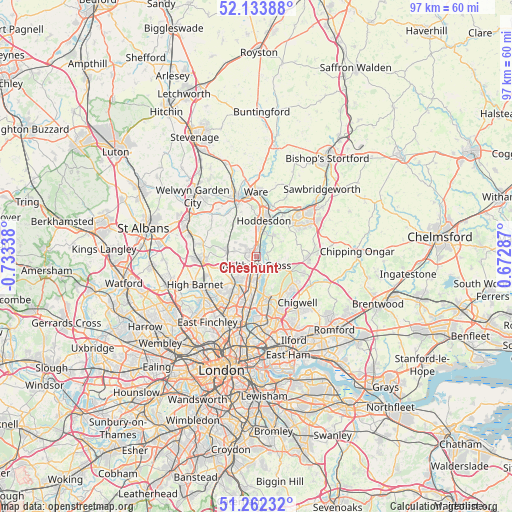
Cheshunt GPS coordinates[2]
51° 42' 0.72" North, 0° 1' 48.936" West
| Map corner | latitude | longitude |
|---|---|---|
| Upper-left | 52.13388°, | -0.73338° |
| Center: | 51.7002°, | -0.03026° |
| Lower-right: | 51.26232°, | 0.67287° |
| Map W x H: | 96.9×96.9 km | = 60.2×60.2mi |
| max Lat: | 60.39635° ⇑70.9% North |
| Cheshunt: | 51.7002° |
| min Lat: | ⇓29.1% South 34.60088° |
| min Long | Cheshunt | max Long |
| -7.64133° | -0.03026° | 32.95536° |
| W 85.9%⇐ | ⇒14.1% E |
Elevation
Elevation of Cheshunt is 24 m = 79 ft, and this is 48.9 m = 160 ft below average elevation for this country.
| Max E: |
515 m = 1690 ft | 77.1% |
| Avg. | 72.9 m = 239 ft | |
| Cheshunt | 24 m = 79 ft | |
Min E: |
-30 m = -98 ft | 22.9% |
See also: Cheshunt elevation on elevation.city.
Geographical zone
Cheshunt is located in North temperate zone (between Tropic of Cancer and the Arctic Circle). Distance of this North polar circle is 1652.7 km =1026.9 mi to North.| Distance of | km | miles | from Cheshunt |
|---|---|---|---|
| North Pole | 4258.5 | 2646.1 | to North |
| Arctic Circle | 1652.7 | 1026.9 | to North |
| Tropic Cancer | 3142.6 | 1952.7 | to South |
| Equator | 5748.5 | 3572 | to South |


Nearby cities:
15 places around Cheshunt: (largest is in red/bold)
• Broxbourne
5.3 km =3.3 mi,  8°
8°
• Buckhurst Hill
9.5 km =5.9 mi,  152°
152°
• Cuffley
5.7 km =3.5 mi,  278°
278°
• Enfield Town
6.6 km =4.1 mi,  214°
214°
• Epping
9.7 km =6 mi,  91°
91°
• Great Amwell
10 km =6.2 mi, 5°
• Hadley Wood
10.3 km =6.4 mi,  248°
248°
• Hoddesdon
6.9 km =4.3 mi, 10°
• Little Amwell
9.2 km =5.7 mi,  358°
358°
• Northaw
8.1 km =5 mi,  272°
272°
• Potters Bar
10.2 km =6.3 mi, 265°
• Roydon
9.3 km =5.8 mi,  31°
31°
• Theydon Bois
9.3 km =5.8 mi,  108°
108°
• Waltham Abbey
2.3 km =1.4 mi,  129°
129°
• Waltham Cross
1.6 km =1 mi,  193°
193°
Sources, notices
• [Note1] Compared only with cities in United Kingdom existing in our database
• [Src1] Map data: © OpenStreetMap contributors (CC-BY-SA)
• [Src2] Other city data from geonames.org with taken over terms of usage.
• [Src3] Geographical zone / Annual Mean Temperature by Robert A. Rohde @ Wikipedia
