Cannock geodata
Cannock (England) is a populated place; located in United Kingdom in Europe/London (GMT+1) time zone. With population of 86,121 people, there are 116 cities with bigger population in this country. Compared to other cities in United Kingdom, 55% of cities are located further ↓South; 55.4% of cities are located further →East and 90.7% of cities have lower elevation than Cannock. Note1


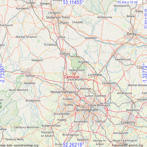
Cannock GPS coordinates[2]
52° 41' 25.62" North, 2° 1' 51.06" West
| Map corner | latitude | longitude |
|---|---|---|
| Upper-left | 53.11455°, | -2.73397° |
| Center: | 52.69045°, | -2.03085° |
| Lower-right: | 52.26219°, | -1.32772° |
| Map W x H: | 94.8×94.8 km | = 58.9×58.9mi |
| max Lat: | 60.39635° ⇑45% North |
| Cannock: | 52.69045° |
| min Lat: | ⇓55% South 34.60088° |
| min Long | Cannock | max Long |
| -7.64133° | -2.03085° | 32.95536° |
| W 44.6%⇐ | ⇒55.4% E |
Elevation
Elevation of Cannock is 154 m = 505 ft, and this is 81.1 m = 266 ft above average elevation for this country.
| Max E: |
515 m = 1690 ft | 9.3% |
| Cannock | 154 m 505 ft | |
| Avg. | 72.9 m = 239 ft | |
Min E: |
-30 m = -98 ft | 90.7% |
See also: Cannock elevation on elevation.city.
Geographical zone
Cannock is located in North temperate zone (between Tropic of Cancer and the Arctic Circle). Distance of this North polar circle is 1542.5 km =958.5 mi to North.| Distance of | km | miles | from Cannock |
|---|---|---|---|
| North Pole | 4148.4 | 2577.7 | to North |
| Arctic Circle | 1542.5 | 958.5 | to North |
| Tropic Cancer | 3252.7 | 2021.1 | to South |
| Equator | 5858.6 | 3640.4 | to South |


Nearby cities:
15 places around Cannock: (largest is in red/bold)
• Acton Trussell
9 km =5.6 mi,  330°
330°
• Bloxwich
8.2 km =5.1 mi,  167°
167°
• Brewood
9.8 km =6.1 mi,  261°
261°
• Brownhills
9.1 km =5.7 mi,  134°
134°
• Burntwood
7 km =4.3 mi,  98°
98°
• Chasetown
7.4 km =4.6 mi,  105°
105°
• Coven
8 km =5 mi,  241°
241°
• Essington
7.1 km =4.4 mi,  194°
194°
• Featherstone
6.6 km =4.1 mi,  219°
219°
• Great Wyrley
3.4 km =2.1 mi,  156°
156°
• Norton Canes
5.1 km =3.2 mi, 114°
• Pelsall
8.1 km =5 mi,  147°
147°
• Penkridge
6.9 km =4.3 mi,  304°
304°
• Rugeley
9.9 km =6.2 mi,  39°
39°
• Shareshill
5.1 km =3.2 mi, 221°
Sources, notices
• [Note1] Compared only with cities in United Kingdom existing in our database
• [Src1] Map data: © OpenStreetMap contributors (CC-BY-SA)
• [Src2] Other city data from geonames.org with taken over terms of usage.
• [Src3] Geographical zone / Annual Mean Temperature by Robert A. Rohde @ Wikipedia
