Tonypandy geodata
Tonypandy (Wales) is a populated place; located in United Kingdom in Europe/London (GMT+1) time zone. With population of 62,545 people, there are 174 cities with bigger population in this country. Compared to other cities in United Kingdom, 73.6% of cities are located further ↑North; 81.6% of cities are located further →East and 90.7% of cities have lower elevation than Tonypandy. Note1


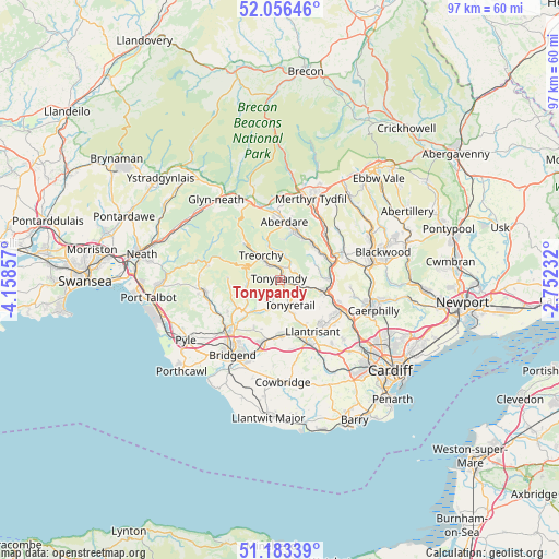
Tonypandy GPS coordinates[2]
51° 37' 19.272" North, 3° 27' 19.584" West
| Map corner | latitude | longitude |
|---|---|---|
| Upper-left | 52.05646°, | -4.15857° |
| Center: | 51.62202°, | -3.45544° |
| Lower-right: | 51.18339°, | -2.75232° |
| Map W x H: | 97.1×97.1 km | = 60.3×60.3mi |
| max Lat: | 60.39635° ⇑73.6% North |
| Tonypandy: | 51.62202° |
| min Lat: | ⇓26.4% South 34.60088° |
| min Long | Tonypandy | max Long |
| -7.64133° | -3.45544° | 32.95536° |
| W 18.4%⇐ | ⇒81.6% E |
Elevation
Elevation of Tonypandy is 154 m = 505 ft, and this is 81.1 m = 266 ft above average elevation for this country.
| Max E: |
515 m = 1690 ft | 9.3% |
| Tonypandy | 154 m 505 ft | |
| Avg. | 72.9 m = 239 ft | |
Min E: |
-30 m = -98 ft | 90.7% |
See also: Tonypandy elevation on elevation.city.
Geographical zone
Tonypandy is located in North temperate zone (between Tropic of Cancer and the Arctic Circle). Distance of this North polar circle is 1661.3 km =1032.3 mi to North.| Distance of | km | miles | from Tonypandy |
|---|---|---|---|
| North Pole | 4267.2 | 2651.5 | to North |
| Arctic Circle | 1661.3 | 1032.3 | to North |
| Tropic Cancer | 3133.9 | 1947.3 | to South |
| Equator | 5739.8 | 3566.5 | to South |


Nearby cities:
15 places around Tonypandy: (largest is in red/bold)
• Clydach Vale
1.8 km =1.1 mi,  286°
286°
• Ferndale
4.3 km =2.7 mi,  7°
7°
• Gilfach Goch
3.5 km =2.2 mi,  200°
200°
• Llwynypia
1.3 km =0.8 mi,  16°
16°
• Maerdy
6.3 km =3.9 mi,  340°
340°
• Ogmore Vale
6.4 km =4 mi,  249°
249°
• Pentre
4.4 km =2.7 mi,  325°
325°
• Pontypridd
8.1 km =5 mi,  105°
105°
• Porth
3.7 km =2.3 mi, 105°
• Price Town
5.6 km =3.5 mi,  265°
265°
• Rhondda
4.1 km =2.5 mi, 6°
• Tonyrefail
4.6 km =2.9 mi,  157°
157°
• Treherbert
7.5 km =4.7 mi,  316°
316°
• Treorchy
5.4 km =3.4 mi, 320°
• Ynysybwl
6.8 km =4.2 mi,  73°
73°
Sources, notices
• [Note1] Compared only with cities in United Kingdom existing in our database
• [Src1] Map data: © OpenStreetMap contributors (CC-BY-SA)
• [Src2] Other city data from geonames.org with taken over terms of usage.
• [Src3] Geographical zone / Annual Mean Temperature by Robert A. Rohde @ Wikipedia
