Easton-in-Gordano geodata
Easton-in-Gordano (England) is a populated place; located in United Kingdom in Europe/London (GMT+1) time zone. With population of 4,824 people, there are 1669 cities with bigger population in this country. Compared to other cities in United Kingdom, 78.5% of cities are located further ↑North; 68.7% of cities are located further →East and 77.8% of cities have higher elevation than Easton-in-Gordano. Note1


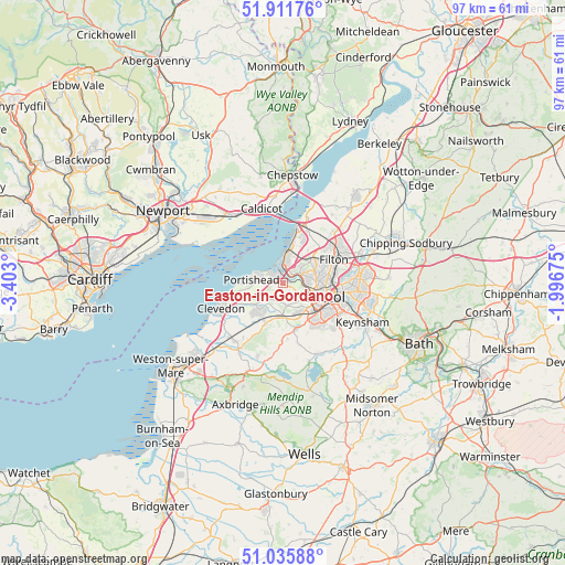
Easton-in-Gordano GPS coordinates[2]
51° 28' 33.312" North, 2° 41' 59.532" West
| Map corner | latitude | longitude |
|---|---|---|
| Upper-left | 51.91176°, | -3.403° |
| Center: | 51.47592°, | -2.69987° |
| Lower-right: | 51.03588°, | -1.99675° |
| Map W x H: | 97.4×97.4 km | = 60.5×60.5mi |
| max Lat: | 60.39635° ⇑78.5% North |
| Easton-in-Gordano: | 51.47592° |
| min Lat: | ⇓21.5% South 34.60088° |
| min Long | Easton-in-Gorda | max Long |
| -7.64133° | -2.69987° | 32.95536° |
| W 31.3%⇐ | ⇒68.7% E |
Elevation
Elevation of Easton-in-Gordano is 23 m = 75 ft, and this is 49.9 m = 164 ft below average elevation for this country.
| Max E: |
515 m = 1690 ft | 77.8% |
| Avg. | 72.9 m = 239 ft | |
| Easton-in-Gordano | 23 m = 75 ft | |
Min E: |
-30 m = -98 ft | 22.2% |
See also: United Kingdom elevation on elevation.city.
Geographical zone
Easton-in-Gordano is located in North temperate zone (between Tropic of Cancer and the Arctic Circle). Distance of this North polar circle is 1677.6 km =1042.4 mi to North.| Distance of | km | miles | from Easton-in-Gordano |
|---|---|---|---|
| North Pole | 4283.5 | 2661.6 | to North |
| Arctic Circle | 1677.6 | 1042.4 | to North |
| Tropic Cancer | 3117.7 | 1937.2 | to South |
| Equator | 5723.6 | 3556.5 | to South |


Nearby cities:
15 places around Easton-in-Gordano: (largest is in red/bold)
• Bishopsworth
8.7 km =5.4 mi,  141°
141°
• Bristol
7.5 km =4.7 mi,  107°
107°
• Brockley
9.6 km =6 mi,  208°
208°
• Clevedon
11.6 km =7.2 mi,  251°
251°
• Dundry
9.5 km =5.9 mi,  154°
154°
• Failand
4.1 km =2.5 mi,  169°
169°
• Felton
9.7 km =6 mi, 173°
• Long Ashton
5.8 km =3.6 mi, 152°
• Nailsea
6.3 km =3.9 mi,  219°
219°
• Pilning
10.5 km =6.5 mi,  22°
22°
• Portishead
4.9 km =3 mi,  277°
277°
• Severn Beach
9.7 km =6 mi, 15°
• Stoke Gifford
11.9 km =7.4 mi,  67°
67°
• Tickenham
8 km =5 mi,  242°
242°
• Winford
10.6 km =6.6 mi, 165°
Sources, notices
• [Note1] Compared only with cities in United Kingdom existing in our database
• [Src1] Map data: © OpenStreetMap contributors (CC-BY-SA)
• [Src2] Other city data from geonames.org with taken over terms of usage.
• [Src3] Geographical zone / Annual Mean Temperature by Robert A. Rohde @ Wikipedia
