Clayton-le-Woods geodata
Clayton-le-Woods (England) is a populated place; located in United Kingdom in Europe/London (GMT+1) time zone. With population of 14,528 people, there are 796 cities with bigger population in this country. Compared to other cities in United Kingdom, 73.6% of cities are located further ↓South; 68.1% of cities are located further →East and 51.8% of cities have lower elevation than Clayton-le-Woods. Note1
Administrative division(s):
- Level 1: England
- Level 2: Lancashire
- Level 3: Chorley District
- Level 4: Clayton-le-Woods


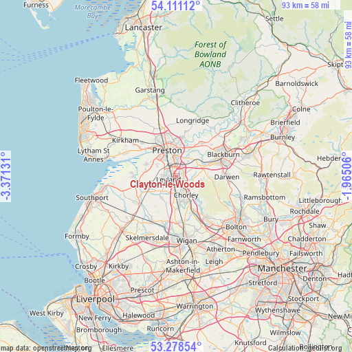
Clayton-le-Woods GPS coordinates[2]
53° 41' 48.804" North, 2° 40' 5.448" West
| Map corner | latitude | longitude |
|---|---|---|
| Upper-left | 54.11112°, | -3.37131° |
| Center: | 53.69689°, | -2.66818° |
| Lower-right: | 53.27854°, | -1.96506° |
| Map W x H: | 92.6×92.6 km | = 57.5×57.5mi |
| max Lat: | 60.39635° ⇑26.4% North |
| Clayton-le-Woods: | 53.69689° |
| min Lat: | ⇓73.6% South 34.60088° |
| min Long | Clayton-le-Wood | max Long |
| -7.64133° | -2.66818° | 32.95536° |
| W 31.9%⇐ | ⇒68.1% E |
Elevation
Elevation of Clayton-le-Woods is 63 m = 207 ft, and this is 9.9 m = 32 ft below average elevation for this country.
| Max E: |
515 m = 1690 ft | 48.2% |
| Avg. | 72.9 m = 239 ft | |
| Clayton-le-Woods | 63 m = 207 ft | |
Min E: |
-30 m = -98 ft | 51.8% |
See also: United Kingdom elevation on elevation.city.
Geographical zone
Clayton-le-Woods is located in North temperate zone (between Tropic of Cancer and the Arctic Circle). Distance of this North polar circle is 1430.6 km =888.9 mi to North.| Distance of | km | miles | from Clayton-le-Woods |
|---|---|---|---|
| North Pole | 4036.5 | 2508.2 | to North |
| Arctic Circle | 1430.6 | 888.9 | to North |
| Tropic Cancer | 3364.6 | 2090.7 | to South |
| Equator | 5970.5 | 3709.9 | to South |


Nearby cities:
15 places around Clayton-le-Woods: (largest is in red/bold)
• Adlington
10.1 km =6.3 mi,  156°
156°
• Blackrod
13 km =8.1 mi,  153°
153°
• Brinscall
6.4 km =4 mi,  97°
97°
• Chorley
6.2 km =3.9 mi, 146°
• Coppull
8 km =5 mi,  175°
175°
• Croston
8 km =5 mi,  241°
241°
• Eccleston
7 km =4.3 mi,  210°
210°
• Euxton
3 km =1.9 mi,  189°
189°
• Haigh
12.1 km =7.5 mi, 152°
• Hoghton
6.8 km =4.2 mi,  51°
51°
• Horwich
13.2 km =8.2 mi,  143°
143°
• Leyland
1.3 km =0.8 mi,  274°
274°
• Preston
7.7 km =4.8 mi,  341°
341°
• Rufford
12 km =7.5 mi,  234°
234°
• Tarleton
10.8 km =6.7 mi,  260°
260°
Sources, notices
• [Note1] Compared only with cities in United Kingdom existing in our database
• [Src1] Map data: © OpenStreetMap contributors (CC-BY-SA)
• [Src2] Other city data from geonames.org with taken over terms of usage.
• [Src3] Geographical zone / Annual Mean Temperature by Robert A. Rohde @ Wikipedia
