Peckham geodata
Peckham (England) is a section of populated place; located in United Kingdom in Europe/London (GMT+1) time zone. With population of 71,552 people, there are 148 cities with bigger population in this country. Compared to other cities in United Kingdom, 78.7% of cities are located further ↑North; 85.4% of cities are located further ←West and 93.6% of cities have higher elevation than Peckham. Note1


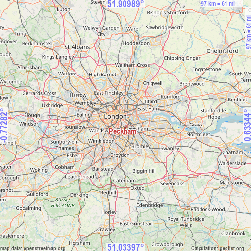
Peckham GPS coordinates[2]
51° 28' 26.508" North, 0° 4' 10.884" West
| Map corner | latitude | longitude |
|---|---|---|
| Upper-left | 51.90989°, | -0.77282° |
| Center: | 51.47403°, | -0.06969° |
| Lower-right: | 51.03397°, | 0.63344° |
| Map W x H: | 97.4×97.4 km | = 60.5×60.5mi |
| max Lat: | 60.39635° ⇑78.7% North |
| Peckham: | 51.47403° |
| min Lat: | ⇓21.3% South 34.60088° |
| min Long | Peckham | max Long |
| -7.64133° | -0.06969° | 32.95536° |
| W 85.4%⇐ | ⇒14.6% E |
Elevation
Elevation of Peckham is 9 m = 30 ft, and this is 63.9 m = 210 ft below average elevation for this country.
| Max E: |
515 m = 1690 ft | 93.6% |
| Avg. | 72.9 m = 239 ft | |
| Peckham | 9 m = 30 ft | |
Min E: |
-30 m = -98 ft | 6.4% |
See also: Peckham elevation on elevation.city.
Geographical zone
Peckham is located in North temperate zone (between Tropic of Cancer and the Arctic Circle). Distance of this North polar circle is 1677.8 km =1042.5 mi to North.| Distance of | km | miles | from Peckham |
|---|---|---|---|
| North Pole | 4283.7 | 2661.8 | to North |
| Arctic Circle | 1677.8 | 1042.5 | to North |
| Tropic Cancer | 3117.5 | 1937.1 | to South |
| Equator | 5723.4 | 3556.4 | to South |


Nearby cities:
15 places around Peckham: (largest is in red/bold)
• Barbican
5.4 km =3.4 mi,  341°
341°
• Battersea
5.9 km =3.7 mi,  270°
270°
• Bethnal Green
5.9 km =3.7 mi,  5°
5°
• Blackheath
5.5 km =3.4 mi,  100°
100°
• Brixton
2.7 km =1.7 mi,  250°
250°
• Brixton Hill
4.4 km =2.7 mi,  236°
236°
• Camberwell
1.7 km =1.1 mi, 269°
• Canary Wharf
4.8 km =3 mi,  44°
44°
• Catford
4.7 km =2.9 mi,  133°
133°
• City of London
4.6 km =2.9 mi, 340°
• City of Westminster
5.3 km =3.3 mi,  299°
299°
• Kennington
2.9 km =1.8 mi, 301°
• Lambeth
3.8 km =2.4 mi,  310°
310°
• London
5.5 km =3.4 mi, 314°
• Poplar
5.6 km =3.5 mi, 42°
Sources, notices
• [Note1] Compared only with cities in United Kingdom existing in our database
• [Src1] Map data: © OpenStreetMap contributors (CC-BY-SA)
• [Src2] Other city data from geonames.org with taken over terms of usage.
• [Src3] Geographical zone / Annual Mean Temperature by Robert A. Rohde @ Wikipedia
