Ilulissat geodata
Ilulissat (Avannaata) is a seat of a first-order administrative division; located in Greenland in America/Godthab (GMT-2) time zone. With population of 4,413 people, there are 2 cities with bigger population in this country. Compared to other cities in Greenland, 72.2% of cities are located further ↓South; 55.6% of cities are located further ←West and 50% of cities have lower elevation than Ilulissat. Note1


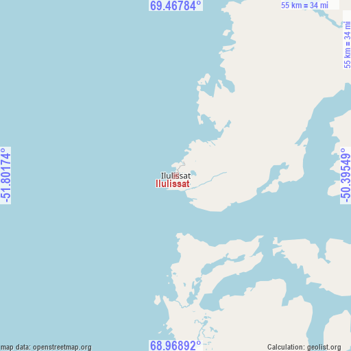
Ilulissat GPS coordinates[2]
69° 13' 11.316" North, 51° 5' 54.996" West
| Map corner | latitude | longitude |
|---|---|---|
| Upper-left | 69.46784°, | -51.80174° |
| Center: | 69.21981°, | -51.09861° |
| Lower-right: | 68.96892°, | -50.39549° |
| Map W x H: | 55.5×55.5 km | = 34.5×34.5mi |
| max Lat: | 77.46666° ⇑27.8% North |
| Ilulissat: | 69.21981° |
| min Lat: | ⇓72.2% South 60.14169° |
| min Long | Ilulissat | max Long |
| -69.23155° | -51.09861° | -21.96221° |
| W 55.6%⇐ | ⇒44.4% E |
Elevation
Elevation of Ilulissat is 11 m = 36 ft, and this is 21.1 m = 69 ft below average elevation for this country.
| Max E: |
242 m = 794 ft | 50% |
| Avg. | 32.1 m = 105 ft | |
| Ilulissat | 11 m = 36 ft | |
Min E: |
1 m = 3 ft | 50% |
See also: Greenland elevation on elevation.city.
Geographical zone
Ilulissat is located in North Frigid zone (between North Pole and Arctic Circle). Distance of this North polar circle is 295.3 km =183.5 mi to South.| Distance of | km | miles | from Ilulissat |
|---|---|---|---|
| North Pole | 2310.5 | 1435.7 | to North |
| Arctic Circle | 295.3 | 183.5 | to South |
| Tropic Cancer | 5090.6 | 3163.2 | to South |
| Equator | 7696.5 | 4782.4 | to South |


Nearby cities:
7 places around Ilulissat: (largest is in red/bold)
• Aasiaat
90.6 km =56.3 mi,  231°
231°
• Kangaatsiaq
139.2 km =86.5 mi,  223°
223°
• Kangerlussuaq
246.4 km =153.1 mi,  176°
176°
• Qasigiannguit
44.7 km =27.8 mi, 184°
• Qeqertarsuaq
96.2 km =59.8 mi,  271°
271°
• Sisimiut
275.1 km =170.9 mi,  202°
202°
• Uummannaq
166.4 km =103.4 mi,  346°
346°
Sources, notices
• [Note1] Compared only with cities in Greenland existing in our database
• [Src1] Map data: © OpenStreetMap contributors (CC-BY-SA)
• [Src2] Other city data from geonames.org with taken over terms of usage.
• [Src3] Geographical zone / Annual Mean Temperature by Robert A. Rohde @ Wikipedia
