Sun Kunda geodata
Sun Kunda (Upper River) is a populated place; located in Gambia in Africa/Banjul (GMT+0) time zone. With population of 1,306 people, there are 55 cities with bigger population in this country. Compared to other cities in Gambia, 73.2% of cities are located further ↑North; 100% of cities are located further ←West and 78% of cities have lower elevation than Sun Kunda. Note1


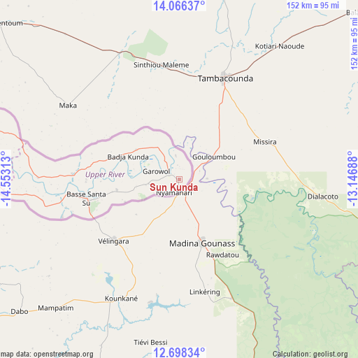
Sun Kunda GPS coordinates[2]
13° 22' 59.988" North, 13° 51' 0" West
| Map corner | latitude | longitude |
|---|---|---|
| Upper-left | 14.06637°, | -14.55313° |
| Center: | 13.38333°, | -13.85° |
| Lower-right: | 12.69834°, | -13.14688° |
| Map W x H: | 152.1×152.1 km | = 94.5×94.5mi |
| max Lat: | 13.8° ⇑73.2% North |
| Sun Kunda: | 13.38333° |
| min Lat: | ⇓26.8% South 13.20194° |
| min Long | Sun Kunda | max Long |
| -16.73389° | -13.85° | -13.85° |
| W 100%⇐ | ⇒0% E |
Elevation
Elevation of Sun Kunda is 29 m = 95 ft, and this is 7.9 m = 26 ft above average elevation for this country.
| Max E: |
49 m = 161 ft | 22% |
| Sun Kunda | 29 m 95 ft | |
| Avg. | 21.1 m = 69 ft | |
Min E: |
1 m = 3 ft | 78% |
See also: Gambia elevation on elevation.city.
Geographical zone
Sun Kunda is located in North Torrid zone (between Equator and Tropic of Cancer). Distance of this Northern Tropic circle is 1117.8 km =694.6 mi to North.| Distance of | km | miles | from Sun Kunda |
|---|---|---|---|
| North Pole | 8519 | 5293.5 | to North |
| Arctic Circle | 5913.1 | 3674.2 | to North |
| Tropic Cancer | 1117.8 | 694.6 | to North |
| Equator | 1488.1 | 924.7 | to South |


Nearby cities:
15 places around Sun Kunda: (largest is in red/bold)
• Badari
27.6 km =17.1 mi,  258°
258°
• Banto Nding
26.9 km =16.7 mi,  290°
290°
• Brifu
15.8 km =9.8 mi,  325°
325°
• Diabugu Basilla
12.2 km =7.6 mi,  242°
242°
• Giroba Kunda
39 km =24.2 mi, 256°
• Gunjur Kuta
33.3 km =20.7 mi,  300°
300°
• Kerewan
39.7 km =24.7 mi,  267°
267°
• Koina
11.3 km =7 mi,  350°
350°
• Kumbija
38.3 km =23.8 mi,  250°
250°
• Nyamanari
5.8 km =3.6 mi,  197°
197°
• Perai
19.8 km =12.3 mi, 270°
• Sanunding
30.9 km =19.2 mi, 248°
• Sudowol
12.8 km =8 mi, 261°
• Sutukoba
22.2 km =13.8 mi,  305°
305°
• Walliba Kunda
18.1 km =11.2 mi, 264°
Sources, notices
• [Note1] Compared only with cities in Gambia existing in our database
• [Src1] Map data: © OpenStreetMap contributors (CC-BY-SA)
• [Src2] Other city data from geonames.org with taken over terms of usage.
• [Src3] Geographical zone / Annual Mean Temperature by Robert A. Rohde @ Wikipedia
