Kerewan geodata
Kerewan (Upper River) is a populated place; located in Gambia in Africa/Banjul (GMT+0) time zone. With population of 585 people, there are 108 cities with bigger population in this country. Compared to other cities in Gambia, 78% of cities are located further ↑North; 86.2% of cities are located further ←West and 55.3% of cities have lower elevation than Kerewan. Note1


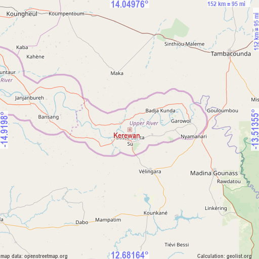
Kerewan GPS coordinates[2]
13° 22' 0.012" North, 14° 13' 0.012" West
| Map corner | latitude | longitude |
|---|---|---|
| Upper-left | 14.04976°, | -14.9198° |
| Center: | 13.36667°, | -14.21667° |
| Lower-right: | 12.68164°, | -13.51355° |
| Map W x H: | 152.1×152.1 km | = 94.5×94.5mi |
| max Lat: | 13.8° ⇑78% North |
| Kerewan: | 13.36667° |
| min Lat: | ⇓22% South 13.20194° |
| min Long | Kerewan | max Long |
| -16.73389° | -14.21667° | -13.85° |
| W 86.2%⇐ | ⇒13.8% E |
Elevation
Elevation of Kerewan is 21 m = 69 ft, and this is 0.1 m = 0 ft below average elevation for this country.
| Max E: |
49 m = 161 ft | 44.7% |
| Avg. | 21.1 m = 69 ft | |
| Kerewan | 21 m = 69 ft | |
Min E: |
1 m = 3 ft | 55.3% |
See also: Gambia elevation on elevation.city.
Geographical zone
Kerewan is located in North Torrid zone (between Equator and Tropic of Cancer). Distance of this Northern Tropic circle is 1119.7 km =695.7 mi to North.| Distance of | km | miles | from Kerewan |
|---|---|---|---|
| North Pole | 8520.8 | 5294.6 | to North |
| Arctic Circle | 5914.9 | 3675.3 | to North |
| Tropic Cancer | 1119.7 | 695.7 | to North |
| Equator | 1486.2 | 923.5 | to South |


Nearby cities:
15 places around Kerewan: (largest is in red/bold)
• Badari
13.2 km =8.2 mi,  106°
106°
• Bakadagy
19.5 km =12.1 mi,  247°
247°
• Banto Nding
18.2 km =11.3 mi,  52°
52°
• Basse Santa Su
6.3 km =3.9 mi,  177°
177°
• Daba Kunda
10.6 km =6.6 mi,  238°
238°
• Demba Kunda
14.1 km =8.8 mi,  202°
202°
• Diabugu
19.9 km =12.4 mi,  275°
275°
• Giroba Kunda
7.6 km =4.7 mi,  166°
166°
• Gunjur Kuta
21.5 km =13.4 mi,  30°
30°
• Jababa
16.2 km =10.1 mi,  270°
270°
• Kumbija
11.7 km =7.3 mi,  162°
162°
• Perai
19.9 km =12.4 mi,  84°
84°
• Sabi
14.9 km =9.3 mi, 173°
• Sanunding
14.2 km =8.8 mi,  130°
130°
• Tuba-Wuli
8.2 km =5.1 mi,  334°
334°
Sources, notices
• [Note1] Compared only with cities in Gambia existing in our database
• [Src1] Map data: © OpenStreetMap contributors (CC-BY-SA)
• [Src2] Other city data from geonames.org with taken over terms of usage.
• [Src3] Geographical zone / Annual Mean Temperature by Robert A. Rohde @ Wikipedia
