Kumbijae geodata
Kumbijae (North Bank) is a populated place; located in Gambia in Africa/Banjul (GMT+0) time zone. With population of 623 people, there are 102 cities with bigger population in this country. Compared to other cities in Gambia, 70.7% of cities are located further ↓South; 55.3% of cities are located further →East and 85.4% of cities have higher elevation than Kumbijae. Note1


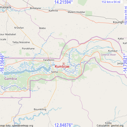
Kumbijae GPS coordinates[2]
13° 31' 59.988" North, 15° 25' 59.988" West
| Map corner | latitude | longitude |
|---|---|---|
| Upper-left | 14.21594°, | -16.13646° |
| Center: | 13.53333°, | -15.43333° |
| Lower-right: | 12.84876°, | -14.73021° |
| Map W x H: | 152×152 km | = 94.4×94.4mi |
| max Lat: | 13.8° ⇑29.3% North |
| Kumbijae: | 13.53333° |
| min Lat: | ⇓70.7% South 13.20194° |
| min Long | Kumbijae | max Long |
| -16.73389° | -15.43333° | -13.85° |
| W 44.7%⇐ | ⇒55.3% E |
Elevation
Elevation of Kumbijae is 10 m = 33 ft, and this is 11.1 m = 36 ft below average elevation for this country.
| Max E: |
49 m = 161 ft | 85.4% |
| Avg. | 21.1 m = 69 ft | |
| Kumbijae | 10 m = 33 ft | |
Min E: |
1 m = 3 ft | 14.6% |
See also: Gambia elevation on elevation.city.
Geographical zone
Kumbijae is located in North Torrid zone (between Equator and Tropic of Cancer). Distance of this Northern Tropic circle is 1101.2 km =684.3 mi to North.| Distance of | km | miles | from Kumbijae |
|---|---|---|---|
| North Pole | 8502.3 | 5283.1 | to North |
| Arctic Circle | 5896.4 | 3663.9 | to North |
| Tropic Cancer | 1101.2 | 684.3 | to North |
| Equator | 1504.8 | 935 | to South |


Nearby cities:
15 places around Kumbijae: (largest is in red/bold)
• Bambali
12.2 km =7.6 mi,  117°
117°
• Buiba Mandinka
11.3 km =7 mi,  189°
189°
• Buniadu
11 km =6.8 mi,  80°
80°
• Dankunku
13.1 km =8.1 mi,  73°
73°
• Farafenni
18.4 km =11.4 mi,  281°
281°
• Jenoi
15.5 km =9.6 mi,  248°
248°
• Karantaba
14.3 km =8.9 mi,  219°
219°
• Katamina
16.3 km =10.1 mi, 83°
• Mansa Konko
14.9 km =9.3 mi,  227°
227°
• Sambang
10.8 km =6.7 mi,  90°
90°
• Sankwia
11.7 km =7.3 mi, 230°
• Sara Kunda
1.8 km =1.1 mi, 90°
• Si Kunda
18.2 km =11.3 mi, 232°
• Soma
15.5 km =9.6 mi, 224°
• Wellingara Ba
13.5 km =8.4 mi,  164°
164°
Sources, notices
• [Note1] Compared only with cities in Gambia existing in our database
• [Src1] Map data: © OpenStreetMap contributors (CC-BY-SA)
• [Src2] Other city data from geonames.org with taken over terms of usage.
• [Src3] Geographical zone / Annual Mean Temperature by Robert A. Rohde @ Wikipedia
