Chlói geodata
Chlói (West Macedonia) is a populated place; located in Greece in Europe/Athens (GMT+3) time zone. With population of 3,079 people, there are 338 cities with bigger population in this country. Compared to other cities in Greece, 75.6% of cities are located further ↓South; 86.9% of cities are located further →East and 94.4% of cities have lower elevation than Chlói. Note1
Administrative division(s):
- Level 1: West Macedonia
- Level 2: Nomós Kastoriás
- Level 3: Dimos Kastoria


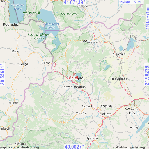
Chlói GPS coordinates[2]
40° 32' 21.048" North, 21° 15' 33.228" East
| Map corner | latitude | longitude |
|---|---|---|
| Upper-left | 41.07139°, | 20.55611° |
| Center: | 40.53918°, | 21.25923° |
| Lower-right: | 40.0027°, | 21.96236° |
| Map W x H: | 118.8×118.8 km | = 73.8×73.8mi |
| max Lat: | 41.72048° ⇑24.4% North |
| Chlói: | 40.53918° |
| min Lat: | ⇓75.6% South 34.8346° |
| min Long | Chlói | max Long |
| 19.40494° | 21.25923° | 29.59361° |
| W 13.1%⇐ | ⇒86.9% E |
Elevation
Elevation of Chlói is 645 m = 2116 ft, and this is 476.1 m = 1562 ft above average elevation for this country.
| Max E: |
1439 m = 4721 ft | 5.6% |
| Chlói | 645 m 2116 ft | |
| Avg. | 168.9 m = 554 ft | |
Min E: |
0 m = 0 ft | 94.4% |
See also: Greece elevation on elevation.city.
Geographical zone
Chlói is located in North temperate zone (between Tropic of Cancer and the Arctic Circle). Distance of this Northern Tropic circle is 1901.6 km =1181.6 mi to South.| Distance of | km | miles | from Chlói |
|---|---|---|---|
| North Pole | 5499.5 | 3417.2 | to North |
| Arctic Circle | 2893.6 | 1798 | to North |
| Tropic Cancer | 1901.6 | 1181.6 | to South |
| Equator | 4507.5 | 2800.8 | to South |


Nearby cities:
15 places around Chlói: (largest is in red/bold)
• Ampelókipoi
9.2 km =5.7 mi,  152°
152°
• Argos Orestiko
9.5 km =5.9 mi,  180°
180°
• Chiliódendro
8.1 km =5 mi,  224°
224°
• Dispilió
6.9 km =4.3 mi,  159°
159°
• Kastoria
2 km =1.2 mi,  169°
169°
• Kolokynthoú
5.6 km =3.5 mi,  226°
226°
• Korisós
10.7 km =6.6 mi,  110°
110°
• Maniákoi
4.5 km =2.8 mi,  196°
196°
• Mavrochóri
6 km =3.7 mi,  120°
120°
• Mesopotamía
9.2 km =5.7 mi,  243°
243°
• Néa Léfki
3.9 km =2.4 mi, 202°
• Néo Kostarázi
13.1 km =8.1 mi, 152°
• Polykárpi
5.6 km =3.5 mi, 110°
• Poreiá
6.9 km =4.3 mi, 215°
• Toichío
6.2 km =3.9 mi,  37°
37°
Sources, notices
• [Note1] Compared only with cities in Greece existing in our database
• [Src1] Map data: © OpenStreetMap contributors (CC-BY-SA)
• [Src2] Other city data from geonames.org with taken over terms of usage.
• [Src3] Geographical zone / Annual Mean Temperature by Robert A. Rohde @ Wikipedia
