Skála Foúrkas geodata
Skála Foúrkas (Central Macedonia) is a populated place; located in Greece in Europe/Athens (GMT+3) time zone. With population of 536 people, there are 1727 cities with bigger population in this country. Compared to other cities in Greece, 66.6% of cities are located further ↓South; 61.9% of cities are located further ←West and 98.4% of cities have higher elevation than Skála Foúrkas. Note1
Administrative division(s):
- Level 1: Central Macedonia
- Level 2: Nomós Chalkidikís
- Level 3: Dimos Kassandra


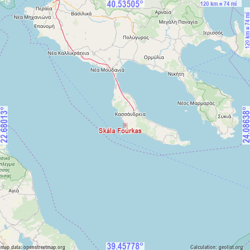
Skála Foúrkas GPS coordinates[2]
39° 59' 54.744" North, 23° 22' 59.7" East
| Map corner | latitude | longitude |
|---|---|---|
| Upper-left | 40.53505°, | 22.68013° |
| Center: | 39.99854°, | 23.38325° |
| Lower-right: | 39.45778°, | 24.08638° |
| Map W x H: | 119.8×119.8 km | = 74.4×74.4mi |
| max Lat: | 41.72048° ⇑33.4% North |
| Skála Foúrkas: | 39.99854° |
| min Lat: | ⇓66.6% South 34.8346° |
| min Long | Skála Foúrkas | max Long |
| 19.40494° | 23.38325° | 29.59361° |
| W 61.9%⇐ | ⇒38.1% E |
Elevation
Elevation of Skála Foúrkas is 3 m = 10 ft, and this is 165.9 m = 544 ft below average elevation for this country.
| Max E: |
1439 m = 4721 ft | 98.4% |
| Avg. | 168.9 m = 554 ft | |
| Skála Foúrkas | 3 m = 10 ft | |
Min E: |
0 m = 0 ft | 1.6% |
See also: Greece elevation on elevation.city.
Geographical zone
Skála Foúrkas is located in North temperate zone (between Tropic of Cancer and the Arctic Circle). Distance of this Northern Tropic circle is 1841.5 km =1144.3 mi to South.| Distance of | km | miles | from Skála Foúrkas |
|---|---|---|---|
| North Pole | 5559.6 | 3454.6 | to North |
| Arctic Circle | 2953.8 | 1835.4 | to North |
| Tropic Cancer | 1841.5 | 1144.3 | to South |
| Equator | 4447.4 | 2763.5 | to South |


Nearby cities:
15 places around Skála Foúrkas: (largest is in red/bold)
• Foúrka
2.8 km =1.7 mi,  73°
73°
• Kallithéa
9.9 km =6.2 mi,  32°
32°
• Kalándra
3.4 km =2.1 mi,  154°
154°
• Kassándreia
6.1 km =3.8 mi, 25°
• Khaniótis
16.8 km =10.4 mi,  89°
89°
• Kryopigí
8.7 km =5.4 mi,  61°
61°
• Néa Fókaia
15 km =9.3 mi,  4°
4°
• Néa Moudhaniá
28.5 km =17.7 mi,  342°
342°
• Néa Poteídaia
22.2 km =13.8 mi,  347°
347°
• Néa Potídhaia
22.3 km =13.9 mi, 347°
• Néa Skióni
13.9 km =8.6 mi,  114°
114°
• Palioúri
24.7 km =15.3 mi,  104°
104°
• Pefkochóri
19.5 km =12.1 mi, 93°
• Políkhronon
12.5 km =7.8 mi,  80°
80°
• Áfytos
12.1 km =7.5 mi,  22°
22°
Sources, notices
• [Note1] Compared only with cities in Greece existing in our database
• [Src1] Map data: © OpenStreetMap contributors (CC-BY-SA)
• [Src2] Other city data from geonames.org with taken over terms of usage.
• [Src3] Geographical zone / Annual Mean Temperature by Robert A. Rohde @ Wikipedia
