Foúrka geodata
Foúrka (Central Macedonia) is a populated place; located in Greece in Europe/Athens (GMT+3) time zone. With population of 543 people, there are 1707 cities with bigger population in this country. Compared to other cities in Greece, 66.7% of cities are located further ↓South; 62.7% of cities are located further ←West and 63.6% of cities have higher elevation than Foúrka. Note1
Administrative division(s):
- Level 1: Central Macedonia
- Level 2: Nomós Chalkidikís
- Level 3: Dimos Kassandra


Foúrka GPS coordinates[2]
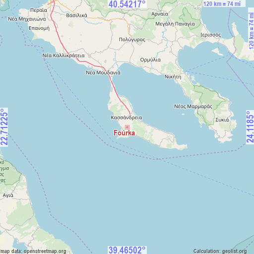
40° 0' 20.592" North, 23° 24' 55.332" East
| Map corner | latitude | longitude |
|---|---|---|
| Upper-left | 40.54217°, | 22.71225° |
| Center: | 40.00572°, | 23.41537° |
| Lower-right: | 39.46502°, | 24.1185° |
| Map W x H: | 119.8×119.8 km | = 74.4×74.4mi |
| max Lat: | 41.72048° ⇑33.3% North |
| Foúrka: | 40.00572° |
| min Lat: | ⇓66.7% South 34.8346° |
| min Long | Foúrka | max Long |
| 19.40494° | 23.41537° | 29.59361° |
| W 62.7%⇐ | ⇒37.3% E |
Elevation
Elevation of Foúrka is 42 m = 138 ft, and this is 126.9 m = 416 ft below average elevation for this country.
| Max E: |
1439 m = 4721 ft | 63.6% |
| Avg. | 168.9 m = 554 ft | |
| Foúrka | 42 m = 138 ft | |
Min E: |
0 m = 0 ft | 36.4% |
See also: Greece elevation on elevation.city.
Geographical zone
Foúrka is located in North temperate zone (between Tropic of Cancer and the Arctic Circle). Distance of this Northern Tropic circle is 1842.3 km =1144.8 mi to South.| Distance of | km | miles | from Foúrka |
|---|---|---|---|
| North Pole | 5558.8 | 3454.1 | to North |
| Arctic Circle | 2953 | 1834.9 | to North |
| Tropic Cancer | 1842.3 | 1144.8 | to South |
| Equator | 4448.2 | 2764 | to South |


Nearby cities:
15 places around Foúrka: (largest is in red/bold)
• Kallithéa
8 km =5 mi,  19°
19°
• Kalándra
4.1 km =2.5 mi,  198°
198°
• Kassándreia
4.7 km =2.9 mi,  358°
358°
• Khaniótis
14 km =8.7 mi,  93°
93°
• Kryopigí
6 km =3.7 mi,  56°
56°
• Néa Fókaia
14.3 km =8.9 mi,  353°
353°
• Néa Moudhaniá
28.7 km =17.8 mi,  337°
337°
• Néa Poteídaia
22.2 km =13.8 mi, 340°
• Néa Potídhaia
22.2 km =13.8 mi, 340°
• Néa Skióni
11.9 km =7.4 mi,  123°
123°
• Palioúri
22.3 km =13.9 mi,  108°
108°
• Pefkochóri
16.9 km =10.5 mi,  96°
96°
• Políkhronon
9.7 km =6 mi,  82°
82°
• Skála Foúrkas
2.8 km =1.7 mi,  253°
253°
• Áfytos
10.5 km =6.5 mi,  9°
9°
Sources, notices
• [Note1] Compared only with cities in Greece existing in our database
• [Src1] Map data: © OpenStreetMap contributors (CC-BY-SA)
• [Src2] Other city data from geonames.org with taken over terms of usage.
• [Src3] Geographical zone / Annual Mean Temperature by Robert A. Rohde @ Wikipedia
