Lávrio geodata
Lávrio (Attica) is a seat of a third-order administrative division; located in Greece in Europe/Athens (GMT+3) time zone. With population of 7,078 people, there are 180 cities with bigger population in this country. Compared to other cities in Greece, 82.5% of cities are located further ↑North; 79.8% of cities are located further ←West and 89.2% of cities have higher elevation than Lávrio. Note1
Administrative division(s):
- Level 1: Attica
- Level 2: Nomarchía Anatolikís Attikís
- Level 3: Dimos Lavreotiki


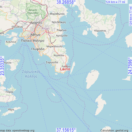
Lávrio GPS coordinates[2]
37° 42' 52.02" North, 24° 3' 23.292" East
| Map corner | latitude | longitude |
|---|---|---|
| Upper-left | 38.26858°, | 23.35335° |
| Center: | 37.71445°, | 24.05647° |
| Lower-right: | 37.15615°, | 24.7596° |
| Map W x H: | 123.7×123.7 km | = 76.9×76.9mi |
| max Lat: | 41.72048° ⇑82.5% North |
| Lávrio: | 37.71445° |
| min Lat: | ⇓17.5% South 34.8346° |
| min Long | Lávrio | max Long |
| 19.40494° | 24.05647° | 29.59361° |
| W 79.8%⇐ | ⇒20.2% E |
Elevation
Elevation of Lávrio is 9 m = 30 ft, and this is 159.9 m = 525 ft below average elevation for this country.
| Max E: |
1439 m = 4721 ft | 89.2% |
| Avg. | 168.9 m = 554 ft | |
| Lávrio | 9 m = 30 ft | |
Min E: |
0 m = 0 ft | 10.8% |
See also: Greece elevation on elevation.city.
Geographical zone
Lávrio is located in North temperate zone (between Tropic of Cancer and the Arctic Circle). Distance of this Northern Tropic circle is 1587.5 km =986.4 mi to South.| Distance of | km | miles | from Lávrio |
|---|---|---|---|
| North Pole | 5813.6 | 3612.4 | to North |
| Arctic Circle | 3207.7 | 1993.2 | to North |
| Tropic Cancer | 1587.5 | 986.4 | to South |
| Equator | 4193.5 | 2605.7 | to South |


Nearby cities:
15 places around Lávrio: (largest is in red/bold)
• Agios Dimítrios Kropiás
20.2 km =12.6 mi,  300°
300°
• Agía Marína
22.1 km =13.7 mi, 302°
• Anávyssos
10.1 km =6.3 mi,  282°
282°
• Ergatikés Katoikíes Attikís
1.8 km =1.1 mi, 280°
• Kalývia Thorikoú
18 km =11.2 mi,  320°
320°
• Keratéa
12.3 km =7.6 mi,  325°
325°
• Kouvarás
14.8 km =9.2 mi, 327°
• Limín Mesoyaías
20.2 km =12.6 mi,  346°
346°
• Markópoulo
21.7 km =13.5 mi, 330°
• Néos Kouvarás
15.1 km =9.4 mi, 323°
• Palaiá Fókaia
9.6 km =6 mi,  273°
273°
• Pláka
6.1 km =3.8 mi, 332°
• Saronída
13.4 km =8.3 mi,  286°
286°
• Thymári
10 km =6.2 mi,  258°
258°
• Ágios Konstantínos
4 km =2.5 mi, 288°
Sources, notices
• [Note1] Compared only with cities in Greece existing in our database
• [Src1] Map data: © OpenStreetMap contributors (CC-BY-SA)
• [Src2] Other city data from geonames.org with taken over terms of usage.
• [Src3] Geographical zone / Annual Mean Temperature by Robert A. Rohde @ Wikipedia
