Thymári geodata
Thymári (Attica) is a populated place; located in Greece in Europe/Athens (GMT+3) time zone. With population of 723 people, there are 1377 cities with bigger population in this country. Compared to other cities in Greece, 82.8% of cities are located further ↑North; 77.2% of cities are located further ←West and 65.5% of cities have higher elevation than Thymári. Note1
Administrative division(s):
- Level 1: Attica
- Level 2: Nomarchía Anatolikís Attikís
- Level 3: Dimos Saronikos


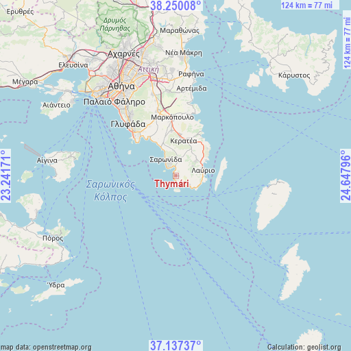
Thymári GPS coordinates[2]
37° 41' 44.916" North, 23° 56' 41.388" East
| Map corner | latitude | longitude |
|---|---|---|
| Upper-left | 38.25008°, | 23.24171° |
| Center: | 37.69581°, | 23.94483° |
| Lower-right: | 37.13737°, | 24.64796° |
| Map W x H: | 123.7×123.7 km | = 76.9×76.9mi |
| max Lat: | 41.72048° ⇑82.8% North |
| Thymári: | 37.69581° |
| min Lat: | ⇓17.2% South 34.8346° |
| min Long | Thymári | max Long |
| 19.40494° | 23.94483° | 29.59361° |
| W 77.2%⇐ | ⇒22.8% E |
Elevation
Elevation of Thymári is 38 m = 125 ft, and this is 130.9 m = 429 ft below average elevation for this country.
| Max E: |
1439 m = 4721 ft | 65.5% |
| Avg. | 168.9 m = 554 ft | |
| Thymári | 38 m = 125 ft | |
Min E: |
0 m = 0 ft | 34.5% |
See also: Greece elevation on elevation.city.
Geographical zone
Thymári is located in North temperate zone (between Tropic of Cancer and the Arctic Circle). Distance of this Northern Tropic circle is 1585.5 km =985.2 mi to South.| Distance of | km | miles | from Thymári |
|---|---|---|---|
| North Pole | 5815.7 | 3613.7 | to North |
| Arctic Circle | 3209.8 | 1994.5 | to North |
| Tropic Cancer | 1585.5 | 985.2 | to South |
| Equator | 4191.4 | 2604.4 | to South |


Nearby cities:
15 places around Thymári: (largest is in red/bold)
• Agios Dimítrios Kropiás
14.5 km =9 mi,  328°
328°
• Agía Marína
16.4 km =10.2 mi, 327°
• Anávyssos
4.3 km =2.7 mi,  358°
358°
• Ergatikés Katoikíes Attikís
8.4 km =5.2 mi,  73°
73°
• Kalývia Thorikoú
16 km =9.9 mi,  353°
353°
• Keratéa
12.6 km =7.8 mi,  13°
13°
• Kouvarás
14.7 km =9.1 mi, 7°
• Kítsi
19.6 km =12.2 mi, 332°
• Lávrio
10 km =6.2 mi,  78°
78°
• Néos Kouvarás
14.3 km =8.9 mi,  3°
3°
• Palaiá Fókaia
2.7 km =1.7 mi, 5°
• Pláka
10.2 km =6.3 mi,  42°
42°
• Saronída
6.5 km =4 mi, 332°
• Vouliagméni
19.6 km =12.2 mi,  312°
312°
• Ágios Konstantínos
6.9 km =4.3 mi,  60°
60°
Sources, notices
• [Note1] Compared only with cities in Greece existing in our database
• [Src1] Map data: © OpenStreetMap contributors (CC-BY-SA)
• [Src2] Other city data from geonames.org with taken over terms of usage.
• [Src3] Geographical zone / Annual Mean Temperature by Robert A. Rohde @ Wikipedia
