Kefalári geodata
Kefalári (Peloponnese) is a populated place; located in Greece in Europe/Athens (GMT+3) time zone. With population of 677 people, there are 1451 cities with bigger population in this country. Compared to other cities in Greece, 84.8% of cities are located further ↑North; 55.5% of cities are located further →East and 76.9% of cities have higher elevation than Kefalári. Note1
Administrative division(s):
- Level 1: Peloponnese
- Level 2: Nomós Argolídos
- Level 3: Dimos Argos-Mykines


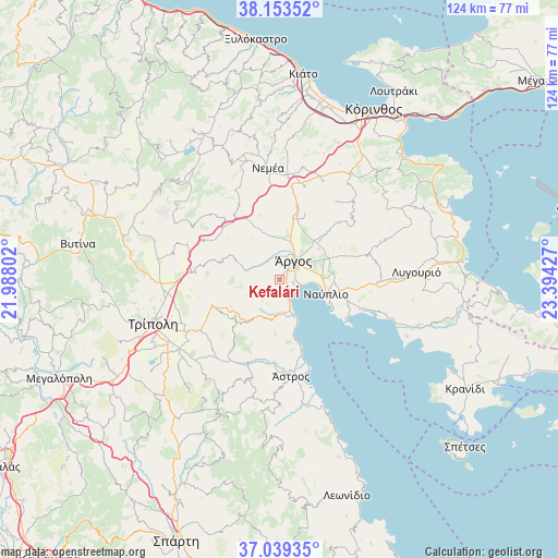
Kefalári GPS coordinates[2]
37° 35' 54.672" North, 22° 41' 28.104" East
| Map corner | latitude | longitude |
|---|---|---|
| Upper-left | 38.15352°, | 21.98802° |
| Center: | 37.59852°, | 22.69114° |
| Lower-right: | 37.03935°, | 23.39427° |
| Map W x H: | 123.9×123.9 km | = 77×77mi |
| max Lat: | 41.72048° ⇑84.8% North |
| Kefalári: | 37.59852° |
| min Lat: | ⇓15.2% South 34.8346° |
| min Long | Kefalári | max Long |
| 19.40494° | 22.69114° | 29.59361° |
| W 44.5%⇐ | ⇒55.5% E |
Elevation
Elevation of Kefalári is 21 m = 69 ft, and this is 147.9 m = 485 ft below average elevation for this country.
| Max E: |
1439 m = 4721 ft | 76.9% |
| Avg. | 168.9 m = 554 ft | |
| Kefalári | 21 m = 69 ft | |
Min E: |
0 m = 0 ft | 23.1% |
See also: Greece elevation on elevation.city.
Geographical zone
Kefalári is located in North temperate zone (between Tropic of Cancer and the Arctic Circle). Distance of this Northern Tropic circle is 1574.6 km =978.4 mi to South.| Distance of | km | miles | from Kefalári |
|---|---|---|---|
| North Pole | 5826.5 | 3620.4 | to North |
| Arctic Circle | 3220.6 | 2001.2 | to North |
| Tropic Cancer | 1574.6 | 978.4 | to South |
| Equator | 4180.6 | 2597.7 | to South |


Nearby cities:
15 places around Kefalári: (largest is in red/bold)
• Anífion
10.9 km =6.8 mi,  51°
51°
• Argolikón
9.8 km =6.1 mi,  75°
75°
• Ayía Triás
10.9 km =6.8 mi,  66°
66°
• Dhalamanára
7.3 km =4.5 mi, 72°
• Kivéri
9 km =5.6 mi,  157°
157°
• Koutsopódi
9.7 km =6 mi,  11°
11°
• Láloukas
8.8 km =5.5 mi, 68°
• Mýloi
5.6 km =3.5 mi, 156°
• Náfplio
10.7 km =6.6 mi,  108°
108°
• Néa Kíos
4.7 km =2.9 mi,  101°
101°
• Néa Tírins
11.4 km =7.1 mi, 84°
• Panarítis
12.2 km =7.6 mi, 72°
• Poullakídha
12.2 km =7.6 mi,  62°
62°
• Árgos
5.4 km =3.4 mi,  43°
43°
• Ínachos
8.9 km =5.5 mi, 35°
Sources, notices
• [Note1] Compared only with cities in Greece existing in our database
• [Src1] Map data: © OpenStreetMap contributors (CC-BY-SA)
• [Src2] Other city data from geonames.org with taken over terms of usage.
• [Src3] Geographical zone / Annual Mean Temperature by Robert A. Rohde @ Wikipedia
